How to drive the military road to Pierre-sur-Haute in France?
Pierre-sur-Haute is the highest point of the Monts du Forez, at an elevation of 1,631 meters (5,351 ft) above sea level located in the Massif Central region of France. Straddling the border between the Loire and Puy-de-Dôme departments, the peak hosts a restricted military radio station accessed via a narrow single-lane road that splits into asphalt on the northern face and raw dirt on the southern slope.
| Road facts: Pierre-sur-Haute | |
|---|---|
| Location | Loire / Puy-de-Dôme, Massif Central, France |
| Elevation | 1,631 m (5,351 ft) |
| Length | 14.3 km (8.8 miles) from Col du Béal |
| Surface | Paved asphalt (North) / Rough dirt track (South) |
| Access | Strictly Restricted / Military security zone at summit |
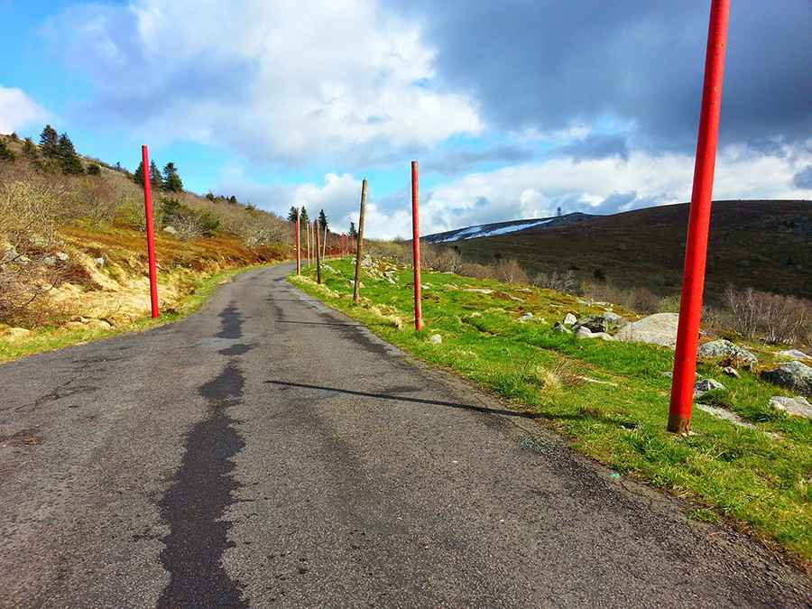
How narrow is the road to Pierre-sur-Haute from Col du Béal?
The northern mountain access begins at the Col du Béal junction on the D40 highway and climbs for 14.3 kilometers (8.8 miles) across the high ridges. Paved in 1961 for military trucks, it is a narrow paved single lane with no center line, painted shoulders, or steel safety guardrails. The final sector to the radio towers is blocked by high security fences and military trespassing signs, restricting private civilian vehicles from reaching the summit.
Why is the southern track of Pierre-sur-Haute restricted to 4x4 vehicles?
The southern route descending toward Le Perrier is an unmaintained, unpaved forest track. The surface consists of a rough mix of loose granite stones, deep dirt ruts, and clay patches that turn into a slick mud slurry during autumn rains. This high plateau segment is fully exposed to severe Atlantic windstorms. Driving this sector requires high ground clearance.
How dangerous is winter weather on the Pierre-sur-Haute road?
At an altitude of 1,631 meters, the mountain road faces sudden winter blizzards and extreme icing driven by the "burle"—the freezing local mountain wind. The narrow asphalt strip from Col du Béal regularly glazes over with black ice. Due to the severe snow drifts that completely bury the track markers, standard four-wheel-drive vehicles become ineffective, forcing the French Air Force personnel to clear the route using specialized tracked snowplows and heavy military machinery to maintain basic access to the high-altitude base.
Pic: Gilles G.