How to drive the paved road to Col de Bostmendieta
Col de Bostmendieta is a mountain pass at an elevation of 1,054m (3,458ft) above sea level, located in the Pyrénées-Atlantiques department of France.
How long is the road to Col de Bostmendieta?
Tucked away in the Nouvelle-Aquitaine region, near the Spanish border, the road to the summit is 8.6 km long starting from the D19 Road near Larrau.
How steep is the road to Col de Bostmendieta?
The climb gains 551 meters of elevation from the D19 junction. While the average gradient is 6.40%, the road features several ramps exceeding 12%. These steep sections, combined with four sharp hairpin turns, force constant gear changes.
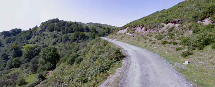
Is the road to Col de Bostmendieta paved?
The road is paved, but the surface is in poor condition due to high-altitude weather and lack of maintenance. The narrow road is often littered with stones from the side slopes. In the upper sectors, the asphalt has disintegrated in many spots, leaving patches of gravel. On the final part of the ascent, the asphalt is heavily degraded, with potholes and loose gravel on the surface.
How challenging is the road to Col de Bostmendieta?
The route features many curves and four tight hairpins with no safety barriers. The narrowness of the road means there is very little room to pass oncoming vehicles, often requiring one driver to stop on the edge of the slope. In wet weather, the combination of old asphalt, loose gravel, and 12% gradients makes the surface very slippery.