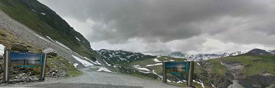
How to drive the unpaved road to Lac de l’Ouillette in Savoie?
Lac de l’Ouillette is a high mountain lake at an elevation of 2,521m (8,270ft) above sea level, located in the Savoie department of France.
Where is Lac de l’Ouillette?
The lake is located in the Auvergne-Rhône-Alpes region, in the southeastern part of the country.
How long is the road to Lac de l’Ouillette?
The road to the summit is a 1.7 km service track that starts from the D902 road near the Col de l'Iseran. It consists of steep ramps designed for ski lift maintenance vehicles.
Is the road to Lac de l’Ouillette unpaved?
The surface is a mix of loose gravel and shifting stones that cause wheels to spin on the steeper hairpins. The road is narrow and lacks safety barriers, leaving no room to pass oncoming maintenance trucks. If you move too close to the edge, the unstable ground can crumble into the valley drops.
Is a 4x4 required for the Lac de l’Ouillette track?
A high-clearance 4x4 is necessary to clear deep ruts and jagged rocks that can hit the underbody.
Is the road to Lac de l’Ouillette open year-round?
Set high in the Vanoise massif, the road is buried under snow from October to June and is only passable once the spring melt is complete. During summer, sudden storms can turn the dust into a slick slurry of mud in minutes. High winds at the summit frequently shift loose stones onto the path. The track is not plowed or maintained for public traffic.