How to drive the 11.6% gravel road to Crête de la Soumaye?
Crête de la Soumaye is a high mountain peak at an elevation of 2,348m (7,703ft) above sea level, located in the Hautes-Pyrénées department of France.
Where is Crête de la Soumaye?
The peak is located in the Occitania Region, in the southern part of the country.
Is the road to Crête de la Soumaye unpaved?
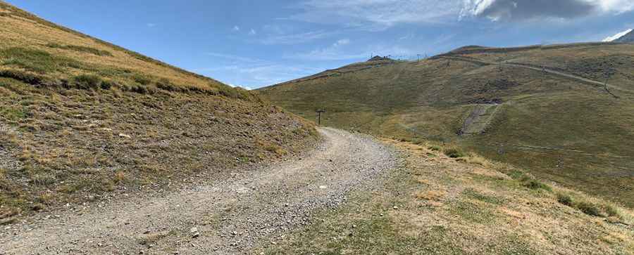
The route starts where the asphalt ends at Col de Portet and follows a 1.1 km unpaved service road. It is a steep track used for ski resort maintenance, where the loose rock surface and the 11.6% gradient are the main obstacles.
How demanding is the 11.6% gradient to Crête de la Soumaye?
The 1.1 km road starts from a parking lot at the summit of Col de Portet and gains 128 meters of elevation in a very short distance. The average gradient is 11.6%, but some ramps are steeper and covered in loose gravel. The road is narrow and has no guardrails or safety barriers.
Can I drive my vehicle to Crête de la Soumaye?
Standard cars do not have the clearance or the traction to handle the rocky ascent. A high-clearance 4x4 is necessary to avoid hitting the underbody against the deep ruts and the stones of the road.
Is the road to Crête de la Soumaye open year-round?
The road is completely buried under snow from October to June, making it impassable even for heavy 4x4 vehicles. Weather at this elevation is unpredictable, and a sudden storm can turn the dry gravel into a slippery mud track.
Pic: Damien B