Col du Gollet: A Technical 4x4 Track in the Massif de la Vanoise
Col du Gollet is a high mountain pass at an elevation of 1,979m (6,492ft) above sea level, located in the Savoie department of France. Situated at the coordinates 45.4501, 6.4385, it serves as the gateway to the higher ridges of the Valmorel ski area.
Where is Col du Gollet?
The pass is located in the Auvergne-Rhône-Alpes region, within the southeastern part of the country. It sits at the top of the Valmorel ski resort, serving as a critical junction on the ridge. From this point, the track continues its ascent toward the more demanding Col du Mottet and Col de Riondet.
| Road facts: Col du Gollet | |
|---|---|
| Elevation | 1,979m (6,492ft) |
| Surface | Unpaved / Two-track / Loose Rocks |
| Max Gradient | 12% |
| Length | 4.6 km (2.85 miles) |
| Vehicle Req. | 4x4 or High-clearance vehicle |
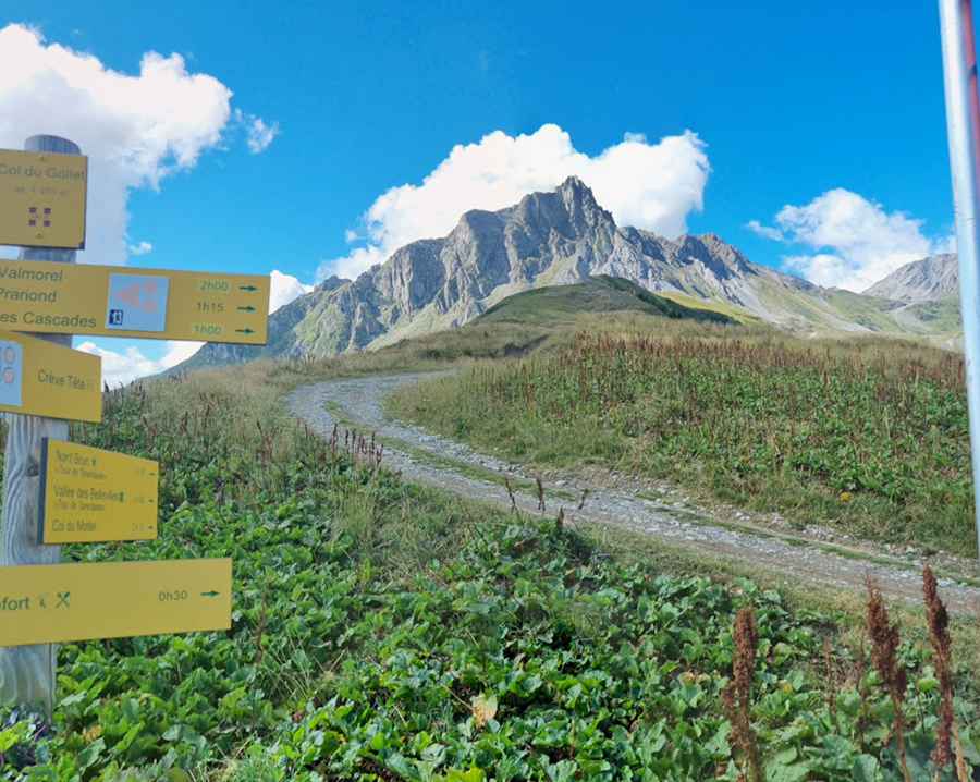
Is the road to Col du Gollet unpaved?
Yes. The route is a rocky two-track service road used primarily for chairlift maintenance and mountain access. As seen on-site, the surface is composed of embedded stones and loose gravel with vegetation growing between the tracks. While it appears stable in dry conditions, the uneven nature of the terrain and the presence of loose scree require a high-clearance vehicle. Standard cars risk bottoming out on the central ridge of the track.
How long and steep is the road to Col du Gollet?
Starting from Les Avanchers-Valmorel, the ascent covers 4.6km (2.85 miles). The climb is constant and features several open hairpins. Beyond the pass, the road narrows significantly and the terrain becomes more aggressive as it leads towards the higher peaks of the Vanoise range.
Is it open year-round?
No. Set high in the Massif de la Vanoise, the road is typically impassable from late October to early June due to heavy snow accumulation. During the summer, it is a popular route for hikers and mountain bikers; motorized drivers should exercise extreme caution and yield to non-motorized users on the narrowest sections.
Pic: David Kan