Puig de la Tossa: Can you drive the 3.2 km military track from Col de la Llose?
Puig de la Tossa is a high mountain peak at an elevation of 2,032m (6,666ft) in the Pyrénées-Orientales, France. The road is a 3.2 km military track that starts at Col de la Llose and leads to an abandoned 19th-century fortification. It is a narrow, unpaved route located west of Pic de Figuéma, where the gravel surface and the isolation are the main obstacles.
| Road facts: Puig de la Tossa | |
|---|---|
| Location | Pyrénées-Orientales, France |
| Elevation | 2,032 m (6,666 ft) |
| Length | 3.2 km (1.98 miles) |
| Average Gradient | 5.34% |
| Surface | Unpaved / Gravel |
How demanding is the 3.2 km climb to Puig de la Tossa?
The road gains 171 meters of elevation over 3.2 km. With an average gradient of 5.34%, the climb is steady, but the track is narrow and lacks any form of safety barriers. The surface is entirely unpaved, with loose stones and deep ruts that can cause wheels to spin if you lose momentum. While it was built for military access, the lack of maintenance means high clearance is necessary to avoid hitting rocks with the underbody.
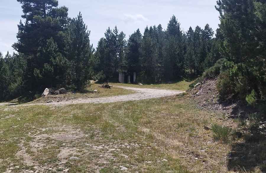
What is the state of the military fortifications at the summit?
At 2,032 meters, the road ends at an abandoned 19th-century military outpost. The site includes underground galleries, a defensive ditch, and old ammunition depots carved into the rock. The area is unmaintained and occasionally used for military camps. The track leading to these ruins is a primitive strip of earth where mountain runoff frequently creates deep gullies across the roadbed.
Is the Puig de la Tossa road open in winter?
No. Heavy snow buries the 3.2 km track from October through June. The 5.34% ramps become impassable as the dirt surface turns into a mix of deep mud and ice. During the summer, sudden storms can wash away sections of the gravel, leaving the road edge unstable. If you go over the side on the narrowest bends, there are no guardrails to stop the vehicle.
What mechanical failures are common on this track?
Sharp rocks on the 3.2 km military road frequently slice through tire sidewalls. The radiator and cooling hoses are under constant stress due to the incline and the thin air at 2,032m. On the descent, you must use engine braking; relying only on the pedal will overheat the brakes on the loose gravel. There is no phone signal and no recovery service; if you break down or get a flat tire, you are on your own.
Pic: Christian Boisseaux