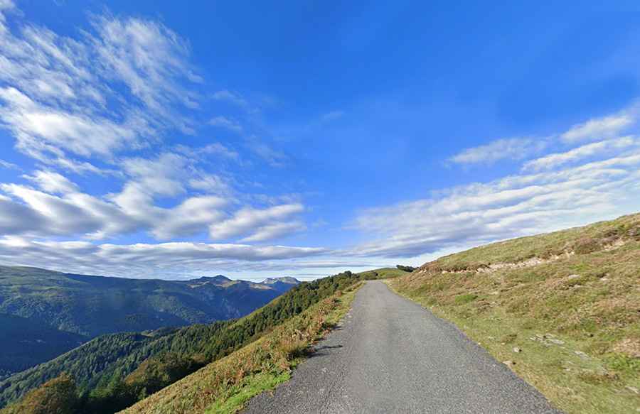
Driving the steep D632 road to Col de la Hourcère in the Pyrenees
Col de la Hourcère (also known as Murkhuillako Lépoua in Basque) is a high mountain pass at an elevation of 1,435m (4,708ft) above sea level in the Pyrénées-Atlantiques department of France. Located in the heart of the Basque country near the Spanish border, the road is a technical masterpiece of steep gradients and narrow asphalt.
| Road facts: Col de la Hourcère | |
|---|---|
| Location | Pyrénées-Atlantiques, France |
| Length | 22.7 km (14.1 miles) |
| Max Gradient | 16.3% |
| Average Gradient | 8.10% |
| Road Name | D632 |
How challenging is the D632 road to Col de la Hourcère?
The drive through the pass via the D632 road is far from a standard mountain crossing. Spanning 22.7 km (14.1 miles) from Lanne-en-Barétous to the junction with the D113 on the way to Col de la Pierre Saint-Martin, the route is a relentless series of turns. While fully paved, the asphalt is often in poor condition, with narrow sections that make passing oncoming traffic a tactical challenge. The climb is categorized as "Hors Catégorie" (HC) for a reason: the 8.10% average gradient hides brutal ramps that kick up to 16.3%, requiring low gearing and high engine torque.
What are the main hazards on the Hourcère pass?
The primary hazard is the combination of the road's narrowness and its extreme steepness. On the 16.3% sections, a front-wheel-drive car can easily lose traction if the surface is damp or covered in fallen leaves, which is common in this heavily forested part of the Pyrenees. The descent toward the Espace Nordique d'Issarbe ski resort is a "brake-killer"; the "countless hairpin bends" do not allow for much natural cooling, so heavy reliance on engine braking is mandatory to prevent fluid boiling and brake fade. In winter, despite the proximity to the ski station, the road can be extremely treacherous due to black ice in the shaded north-facing sectors.
Is Col de la Hourcère open year-round?
Given its elevation and the harsh Atlantic weather patterns that hit the western Pyrenees, the pass is frequently closed by snow from late November until late April. Even when the road is officially "open," sudden mountain storms can reduce visibility to zero and create flash-flood conditions on the lower slopes. The high-altitude terrain is rugged and remote, meaning mobile signal is spotty at best. Drivers should ensure their vehicle's cooling system is in top shape before attempting the climb, as the slow-speed, high-load nature of the ascent is a prime recipe for engine overheating.
How does the road connect to other Pyrenean passes?
The D632 is a strategic link in the Pyrenees, acting as a vertical gateway between the lower valleys and the high-altitude border crossings. After reaching the 1,435m summit, the road continues southward to merge with the D113, providing a direct (though demanding) route toward the Spanish border. This network of roads is a favorite for those testing the limits of their vehicles, but the high concentration of switchbacks and the unpredictable condition of the pavement means you should never underestimate the time required to complete the crossing.