How to get to Puy de la Perdrix in the Massif Central?
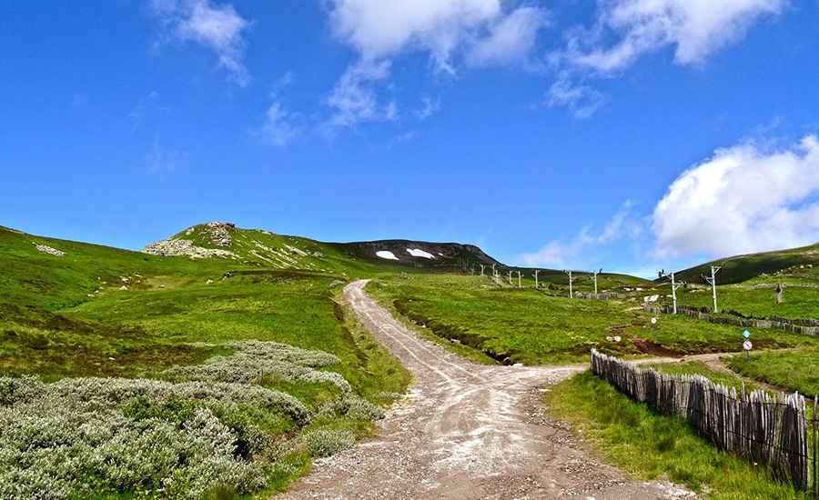
Puy de la Perdrix is a high mountain peak located in the Puy-de-Dôme department of France. It is one of the highest peaks in central France. A gravel road, southeast of the peak, ends at 1,787m (5,862ft) above sea level, at a cable car station near the summit.
Where is Puy de la Perdrix?
The peak is located in the Auvergne-Rhône-Alpes region, in the central part of the country. At the top, you'll find a superb view of the Auvergne countryside and Super Besse.
What’s the Funitel de La Perdrix?
Near the summit, there’s a cable car known as the Funitel de La Perdrix. It’s said to be the only cable car in the Massif Central. The summit is also well known as a paragliding hotspot.
How long is the unpaved road to Puy de la Perdrix?
The road is a chairlift access track for the Super Besse station. It’s totally unpaved and closed to private vehicles. A 4x4 vehicle is required. Starting from the paved D149D, the road to the station is 3.4km (2.11 miles) long. Over this distance, the elevation gain is 500m, with an average gradient of 14.70%.
Is the unpaved road to Puy de la Perdrix open in winter?
Set high in the Massif du Sancy of the Massif Central, the road is totally impassable in winter.
Is Puy de la Perdrix worth the drive?
The summit of Le Puy de la Perdrix offers visitors a breathtaking panoramic view of the surrounding landscape, which includes not only the Chaudefour Valley, but also other peaks in the Massif du Sancy, such as Puy de Sancy and Puy Ferrand.
Pic: bodha jac