Drive Like a Pro on the Open Road Sections of the 24h of Le Mans Track
The Circuit de la Sarthe, used for the 24 Hours of Le Mans, includes public roads that are open to normal traffic most of the year. Located in northwestern France, this unique layout lets drivers experience more than 9 kilometers of a track known worldwide. While you won’t be racing, you’ll still be driving a section of one of motorsport’s most historic circuits.
Where is the 24h of Le Mans track?
The track is located in the Sarthe department, in the Pays de la Loire region, in the northwestern part of France. It runs around the city of Le Mans, using a mix of dedicated racing sections and public roads.
What’s the history of the track?
The first 24 Hours of Le Mans race took place in 1923. The goal was to test vehicle endurance on a long and demanding course. The layout has changed over the years, but much of it still follows the original network of roads around Le Mans.
How long is the full track?
The full circuit measures 13.626 kilometers (8.47 miles). It combines permanent race sections with public roads that are closed to traffic only during racing events and test sessions.
Which parts are open to the public?
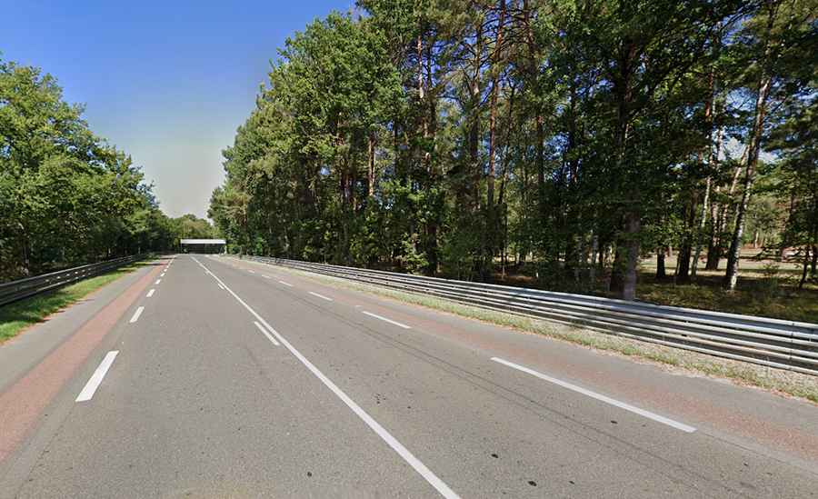
More than 9 kilometers of the track are open to the public throughout the year. This includes well-known sections like the Mulsanne Straight (D338) and the road between Mulsanne Corner and the Porsche Curves. These stretches are standard public roads and follow normal traffic rules.
When is it closed to public traffic?
The public road sections are closed during the race week in June and for other official activities like testing. Outside of those times, they’re accessible to any driver.
What is it like to drive on it?
Driving the open parts of the Circuit de la Sarthe gives you a chance to be on a real race track—but under regular road conditions. There are speed limits, and traffic laws apply, but you’ll be on the same asphalt used during the 24-hour race.
Road suggested by: Baptiste Roger