How to drive the scary Piste de Vignols in the Alpes-Maritimes?
Hameau de Vignols is a little hamlet at an elevation of 1,675m (5,495ft) above sea level, located in the Alpes-Maritimes department in the Provence-Alpes-Côte d'Azur region of France. If you’re scared to drive on narrow mountain roads, along this route, you’ll be terrified.
Is the road to Vignols unpaved?
Set high in the Mercantour National Park, the road to the hamlet is totally unpaved but navigable by most passenger vehicles. However, a high-clearance vehicle is recommended. It’s called Piste de Vignols. The road ends in a small car park below the hamlet, at the Mercantour park sign.
How challenging is Piste de Vignols?
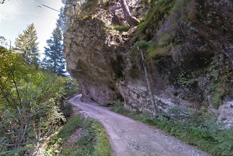
Located in the southeastern part of the country, to the east of Col de la Couillole, the road to the town is extremely defiant. Known as the track that never ends, the road has narrow tunnels, dangerous drop-offs, wooden bridges, and extremely narrow sections, totally impassable for 2 medium cars at the same time. Crossing many rivers and creeks, the road can be impassable after rains. It’s one of the most challenging drives in the area.
How long is Piste de Vignols?
Starting from a tiny unlit tunnel on Roubion, the road to the town is 7.5 km (4.66 miles) long. Over this distance, the elevation gain is 357 m. The average gradient is 4.76%.