Route de Thiéry is a balcony road to Col de la Madone
Col de la Madone is a mountain pass at an elevation of 1.165m (3,822ft) above the sea level, located in the Alpes-Maritimes department, in the Provence-Alpes-Côte d'Azur region of southeastern France. It’s one of the French balcony roads.
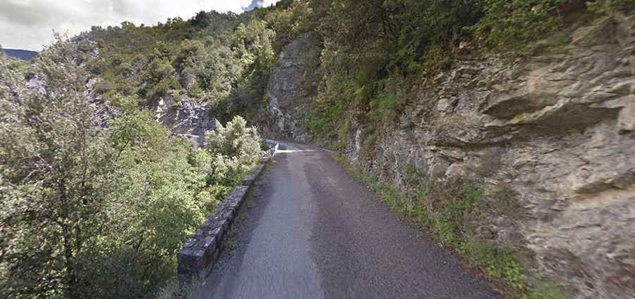
The road to the summit is totally paved, with countless hairpin turns and narrow bridges. It’s called D226, also known as Route de Thiéry. The road is 13.8 km (8.57 miles) long, running from Villars-sur-Var to Thiéry. The road has some narrow parts, so proceed cautiously and hope no other vehicles come from the other direction. Not recommended if you don't know how to reverse. The climb follows mostly the course of the river Le Riou Blanc, a tributary of the Var.
Plan about 30 minutes to complete the drive without any stop. The road to the summit is very steep, hitting a 16% of maximum gradient through some of the ramps. Starting at Villars-sur-Var, the ascent is 13km long. Over this distance the elevation gain is 903 meters. The average gradient is 6.5%. Not recommended to beginner riders. A balcony road is a hair-raising lane cut into the sides of sheer cliffs. It’s a kind of road not for those who fear heights. There is little room for error on these roads. It’s normal for your palms to sweat looking at those photos, imagine what it must have been like before the barriers.