What are the most spectacular roads in France?
France is a true paradise for those wishing to experience the most spectacular roads, and it provides endless experiences for each driver. From stunning balcony roads, mountain passes, and coastal drives, to roads disappearing with the tides, it hosts more than 750 roads listed as the most spectacular in the world.
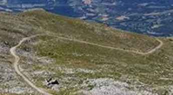
Located in the western part of Europe, France covers an area of 551,695 square kilometers and shares borders with 7 countries: Belgium, Luxembourg, Germany, Switzerland, Italy, Spain, and Andorra. With high mountains in the Alps and the Pyrenees, the roads of the country are famous worldwide because of the Tour de France, the most important cycling race. When traveling to the country, be sure to experience a drive through the best balcony roads. Dramatically carved out of rock on the side of mountains, the balcony roads are a unique experience for any rider.
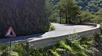
The country also hosts iconic roads, known worldwide, including Col du Chaussy, a mountain pass at 1,533m (5,029ft) above sea level, famous for the “Lacets de Montvernier,” a special 3 km stretch with 17 hairpins as the road virtually climbs a cliff, or Col de Turini, a treacherous Alpine road with a legendary driving history, as one of the most dangerous and challenging stages of the Monte Carlo Rally and one of the most scenic drives in the world. For those preferring another kind of experience, don’t forget to drive Passage du Gois, the tide-covered road. It’s a natural passage flooded twice a day by the high tide leading to the island of Noirmoutier.
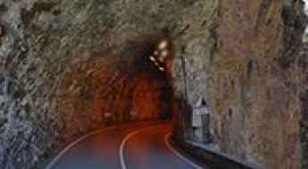
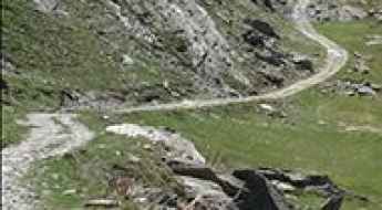
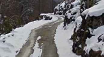
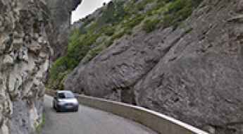
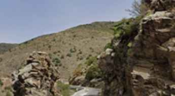
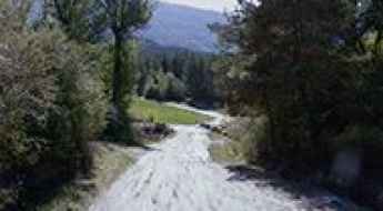
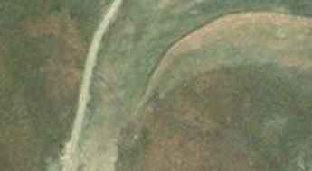
Taking on the Twists and Turns of Gorges de la Mescla
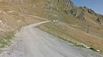
Gorges de la Mescla is a very scenic canyon located in the Alpes-Maritimes department, in the Provence-Alpes-Côte d'Azur region of France.
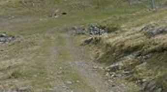
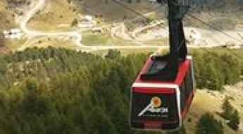
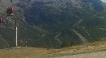
Le Lac
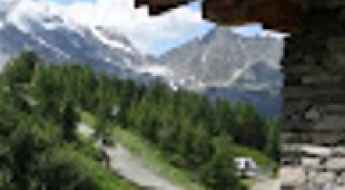
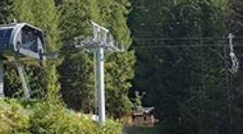
Le Lac is a chairlift at an elevation of 2.487m (8,159ft) above the sea level, located in the Alpes-de-Haute-Provence department in the Provence-Alpes-Côte d'Azur region of southeastern France.
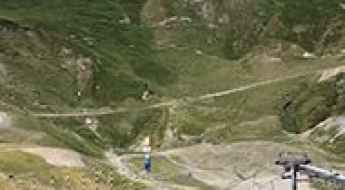
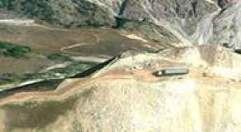
Col de Jaffueil
Col de Jaffueil is a high mountain pass at an elevation of 2.494m (8,182ft) above the sea level, located in the Hautes-Alpes department in southeastern France.
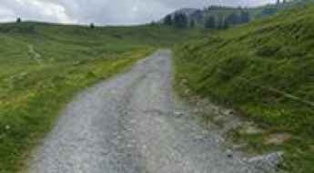
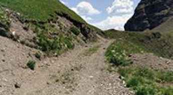
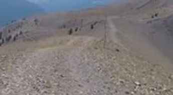
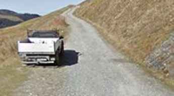
Driving the intimidating 4x4 track to Crete de la Balme
Crete de la Balme is a high-altitude mountain crossing at an elevation of 2,570 meters (8,431 ft) above sea level, located in the Hautes-Alpes department of southeastern France. Perched within the Massif des Cerces, this track is primarily a service trail for a chairlift, which means it is designed for extreme utility rather than transit. Connecting the Col de Frejus with the Col de Mea, this 1.9-kilometer stretch is a raw, unpaved ridge road that offers a high-load technical driving experience where the vertical exposure is total and the margin for error is non-existent.
A wild military road to Vallon de Savine
Vallon de Savine is a high mountain peak at an elevation of 2.227m (7,306ft) above the sea level, located in the northern Cottian Alps, in the Savoie department in the Auvergne-Rhône-Alpes region in south-eastern France.
An old military road to Fort de Dormillouse
Fort de Dormillouse is a military fortress at an elevation of 2.480m (8,136ft) above the sea level, located in the Alpes-de-Haute-Provence department in the Provence-Alpes-Côte d'Azur region of France.
Ultimate 4wd destination: Cima di Tombue
Cima di Tombue is a mountain pass at an elevation of 1.200m (3,937ft) above the sea level, located in the Haute-Corse department of France on the island of Corsica. It’s one of the highest roads of Corsica.
Driving the historic military road to Col Mercière in the Alps
Col Mercière is a high mountain pass at an elevation of 2,346m (7,769ft) above sea level, located in the Alpes-Maritimes department of southeastern France. Tucked away in the heart of the Mercantour National Park, this pass is one of the most iconic high-altitude tracks overlooking the ski resort of Isola 2000.
Travel guide to the top of Le Collu in the Alps
Le Collu is a high mountain peak at an elevation of 1.988m (6,522ft) above the sea level, located in the Haute-Savoie department in the Auvergne-Rhône-Alpes region in south-eastern France.
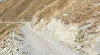
Driving to Col de l'Aiguille: A brutal 18% 4x4 climb in the Tarentaise Valley
Located in the Savoie department of southeastern France, the track to Col de l'Aiguille is an extreme high-altitude challenge that pushes the boundaries of off-road driving. Reaching an elevation of 2,606m (8,549ft) above sea level in the heart of the Tarentaise Valley, this is a raw, unpaved service road used by the Station Sainte-Foy resort. It is a journey defined by pure verticality, where the combination of loose stones and a staggering incline creates a high-stakes environment for any vehicle.
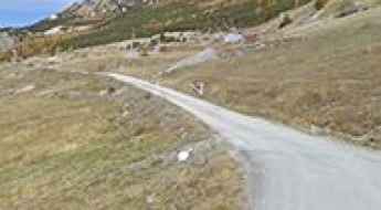
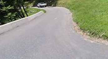
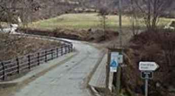
Is the D221 road to Oulles safe for driving?
The D221 road leading to the mountain village of Oulles, in the Isère department of the French Alps, is one of the most vertigo-inducing local routes in the Taillefer massif. At an elevation of 1,483m (4,865ft), the village remained isolated from vehicular traffic until 1963. Technically, the road is a feat of mountain engineering, literally clawed into the rockface to provide access to what was once only accessible via mule trails.
Col d'Agnes is an awe-inspiring road in the French Pyrenees
Col d'Agnes is a high mountain pass at an elevation of 1.573m (5,160ft) above the sea level, located in the Ariège department in the Occitanie region of France.
Driving to Col de Platé: A brutal 13% 4x4 climb in the Haute-Savoie Alps
Located in the Haute-Savoie department of southeastern France, the track to Col de Platé is an extreme Alpine ascent that sits at the very limit of motorized exploration. Reaching an elevation of 2,362m (7,749ft) above sea level in the Auvergne-Rhône-Alpes region, this is a raw service road used for ski resort maintenance. It is a journey defined by loose shale, high-altitude isolation, and a vertical gain that will push your vehicle's low-range gearbox to its absolute limit.
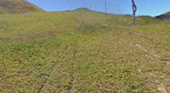
Col de Mahourat: Can you drive the 200m grassy track from the D132?
Col de Mahourat is a high mountain pass at an elevation of 1,740m (5,708ft) above sea level, located in the Pyrénées-Atlantiques department of France. Located near the Spanish border, the access is a 200-meter unpaved track that starts from the D132 road, the main route leading to Col de la Pierre Saint-Martin. It is a short, primitive path where the grass surface and the lack of grip are the main obstacles.
Driving to Crête de Mourtara: A brutal 15% 4x4 climb in the Cauterets Pyrenees
Located in the Hautes-Pyrénées department of south-western France, the track to Crête de Mourtara is an extreme high-altitude challenge in the heart of the Pyrenees National Park. Reaching an elevation of 2,421m (7,942ft) above sea level, this is a raw, unpaved service road used for the maintenance of the Cauterets-Le Lys ski resort. It is a journey of pure verticality, where the combination of loose shale and a staggering incline creates a high-stakes environment for any vehicle.
Travel guide to the top of Roc d'Aude
Roc d'Aude (Roc d'Auda) is a high mountain peak at an elevation of 2.361m (7,746ft) above the sea level, located in the Pyrénées-Orientales department in southern France.
L'Autapie
L'Autapie is a high mountain peak at an elevation of 2.409m (7,903ft) above the sea level, located in the Alpes-de-Haute-Provence department in the Provence-Alpes-Côte d'Azur region of southeastern France.
Pointe de Pastourlet
Pointe de Pastourlet is a high mountain pass at an elevation of 2.313m (7,588ft) above the sea level, located in the Hautes-Alpes department in southeastern France.
Colle de Carsene
Colle de Carsene is a high mountain pass at an elevation of 2.221m (7,286ft) above the sea level, located in the Cottian Alps, between France and Italy.
Hospice de Rioumajou
Hospice de Rioumajou is a high mountain refuge&restaurant at an elevation of 1.559m (5,114ft) above the sea level, located in the Hautes-Pyrénées department, in the Occitanie region of France.
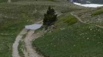
Driving the narrow road to Pla de las Peyres in the Pyrenees
Pla de las Peyres is a high mountain plateau at an elevation of 1,707m (5,600ft) above sea level, located in the Ariège department of France.
Col de Malabergue
Colle Malaberghe is a high mountain pass at an elevation of 2.225m (7,299 ft) above the sea level, located in the Cottian Alps, between France and Italy.
Col du Tra: a curvy steep road only for experienced drivers
Col du Tra is a high mountain pass at an elevation of 1.312m (4,304ft) above the sea level, located in the Savoie department in the Auvergne-Rhône-Alpes region in south-eastern France. Overall this road is a goody for motorbike drivers – but be careful – it could be your last.
Col de Chaudun
Col de Chaudun is a high mountain pass at an elevation of 1.693m (5,554ft) above the sea level, located in the Hautes-Alpes department, in southeastern France.
Sommet du Becoin
Sommet du Becoin is a high mountain peak at an elevation of 2.311m (7,582ft) above the sea level, located in the Savoie département in the Auvergne-Rhône-Alpes region in south-eastern France.
Lago d'Arpon
Lago d'Arpon is a high mountain lake at an elevation of 1.830m (6,003ft) above the sea level located on the border of France and Italy.
Take the Scenic Route and Discover Col de la Croix
Bocca à Croce is a mountain pass at an elevation of 929m (3,047ft) above the sea level, located in the Haute-Corse department of France on the island of Corsica.
An Epic Balcony Road to Col du Pas de Lauzun
Col du Pas de Lauzun is a mountain pass at an elevation of 504m (1,653ft) above sea level, located in the Drôme department in the Auvergne-Rhône-Alpes region of France. It’s one of the famous French balcony roads.
Col de la Sagette
Col de la Sagette is a high mountain pass at an elevation of 1.978m (6,489ft) above the sea level, located in the Pyrénées-Atlantiques department in south-western France.
Las Donnas
Las Donnas is a high mountain peak at an elevation of 2.260m (7,414ft) above the sea level, located in the French alps, in the Alpes-Maritimes department in southeastern France.
Refuge des Camporells
Refuge des Camporells is a high mountain refuge at an elevation of 2.252m (7,388ft) above the sea level, located in the Pyrénées-Orientales department in southern France, near the Spanish border.
Col du Couvercle: A High-Altitude 4x4 Track in the Beaufortain Massif
Col du Couvercle is a mountain pass at an elevation of 2,296m (7,532ft) above sea level, located in the Savoie department of France. Coordinates: 45.64604, 6.60637. The pass sits on the ridge within the Beaufortain Massif, connecting the Arêches valley with the Treicol pastures.
A challenging road to Col de Creu in the Pyrenees
Col de Creu is a high mountain pass at an elevation of 1,712m (5,616ft) above sea level, located in the Occitania region of France. It’s one of the French balcony roads.

What are the technical logistics for driving in France?
Navigating France’s road infrastructure requires a technical understanding of the Autoroute network and specific mountain driving protocols. From high-speed corridors to the extreme vertical gain of the Alps, driving in France demands strict logistical planning, especially regarding fuel management, brake cooling, and environmental compliance in urban zones.
Coume Lounque
Coume Lounque is a high mountain peak at an elevation of 2.362m (7,749ft) above the sea level, located in the Hautes-Pyrénées department, in south-western France.
La Marquise
La Marquise is a high mountain lift at an elevation of 2.440m (8,005ft) above the sea level, located in the Savoie department in the Auvergne-Rhône-Alpes region in south-eastern France.
Col de la Replanette
Col de la Replanette is a high mountain pass at an elevation of 2.328m (7,637ft) above the sea level, located in the Savoie department in the Auvergne-Rhône-Alpes region in south-eastern France. The average gradient is 13.35%.
Road D25C: The Abandoned 13% Shortcut at Col de Pailhères
Located on the border of the Aude and Ariège departments in southwestern France, Road D25C is a short but extreme mountain track. Situated entirely above 1,900m sea level, this route was originally designed as a high-altitude shortcut between Col de Pailhères and Col des Trabesses.
Le Petit Cordeil
Le Petit Cordeil is a high mountain peak at an elevation of 1.768m (5,800ft) above the sea level, located in the Alpes-de-Haute-Provence department in southeastern France. The average gradient is 8.98%.
Driving the high military road to Col de la Roubine in the Mercantour
Col de la Roubine is a high mountain pass at an elevation of 2,304m (7,559ft) above sea level, located in the Alpes-Maritimes department of southeastern France. This pass is a key point along the rugged ridge that separates the Tinée Valley from the Italian border, offering one of the most immersive 4x4 experiences in the Mercantour National Park.
Coll de Pradelles
Coll de Pradelles is a high mountain pass at an elevation of 1.995m (6,545ft) above the sea level, located in the Pyrénées-Orientales department in southern France, near the Spanish border.
Le Chalvet
Le Chalvet is a high mountain peak at an elevation of 2.583m (8,474ft) above the sea level, located in the Hautes-Alpes department in southeastern France, near the Italian border.
Driving the steep military track to Col de la Vallette in the Mercantour
Col de la Vallette is a high mountain pass at an elevation of 2,349m (7,706ft) above sea level, located in the Alpes-Maritimes department of southeastern France. Perched within the Mercantour National Park, this pass is part of a complex network of former military roads overlooking the Italian border.
Crete de la Serre Thibaud
Crete de la Serre Thibaud is a high mountain peak at an elevation of 2.517m (8,257ft) above the sea level, located in the Hautes-Alpes department in southeastern France.
Col de l’Alpet
Col de l’Alpet is a high mountain peak at an elevation of 2.447m (8,028ft) above the sea level, located in the Hautes-Alpes department in southeastern France.