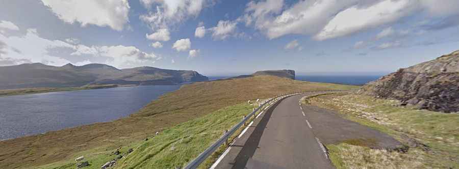
Ultimate Scenic Drive in Faroe Islands: Eidisskard and Foldarskardh Mountain Passes
Eiðisskarð is a mountain pass at an elevation of 404m (1,325ft) above sea level located at the northern tip of Eysturoy in the Faroe Islands.
Is the road to Eiðisskarð in Faroe Islands paved?
The scenic road to the summit is totally paved. It’s pretty challenging, with narrow parts and very steep sections.
How long is the road to Eiðisskarð?
The pass is 11.3 km (7.02 miles) long, running west-east from Eiði, a large village on the north-west tip of Eysturoy to Funningur, a town on the north-west coast of Eysturoy. To the east of the pass, the road climbs up to Foldarskardh, another mountain pass, at 276m (905ft) above sea level.
Is the road to Eiðisskarð worth it?
To drive the road without stopping will take most people between 20 and 25 minutes. The road zigzags near Slættaratindur, the highest mountain in the Faroe Islands, at an altitude of 880 metres. At the summit there is a small parking lot.