Discovering the Thrills of Whinlatter Pass: A Breathtaking Road in Cumbria
Whinlatter Pass is a mountain pass at an elevation of 337m (1,105ft) above sea level located in Cumbria, England.
Where is Whinlatter?
Set high in the Whinlatter Forest Park, within the Thornthwaite Forest, the pass is located in the northern Lake District of Cumbria. It’s the northernmost road pass in the district. The Whinlatter Pass is a far less severe route than many of its counterparts such as Newlands Pass, Honister Pass, Wrynose Pass and Hardknot Pass.
How long is Whinlatter Pass?
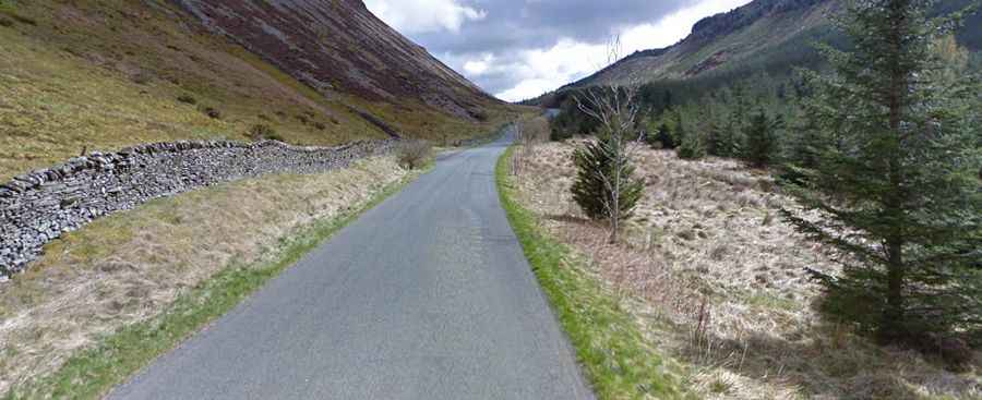
The narrow road to the summit is paved and very steep. It’s called B5292, aka Whinlatter Pass Road. The pass is 9.81km (6.1 miles) long, running west-east from High Lorton to the south of Cockermouth to Braithwaite, to the west of Keswick.
Is Whinlatter Pass open?
Access to the pass is typically open all year round but can be icy in winter. Come suitably clothed – it’s either wet or windy up here at the best of times.
Is Whinlatter Pass worth the drive?
Near the top of the pass, in the Whinlatter Forest Visitor Centre, is a gift shop, and a restaurant. The summit offers great views of with views over Bassenthwaite Lake. Take care on the uphill section as there are often cyclists taking advantage of the steep descent and underestimating the corners.
How hard is Whinlatter pass?
The pass has been featured in the Tour of Britain cycle race. It’s pretty steep, hitting a 15% of maximum gradient through some of the ramps. Starting from High Lorton, the ascent is 6 km long. Over this distance, the elevation gain is 246 meters. The average percentage is 4.1 %. And starting from Braithwaite, the ascent is 4 km long. Over this distance, the elevation gain is 228 meters. The average percentage is 5.7 %.