The Burway is a dangerously steep drive in Shropshire
The Burway is the name of a very demanding drive located in Shropshire county, England.
Where is The Burway?
The Burway is located in the West Midlands region, in the western part of the country, within the Cardingmill Valley.
Can you drive up the Long Mynd?
The road is entirely paved and quite narrow. It climbs up to the top of Long Mynd, a mountain plateau at an elevation of 488m (1,601ft) above sea level. From the top, you can take in fantastic views across Shropshire and beyond.
How is the Burway?
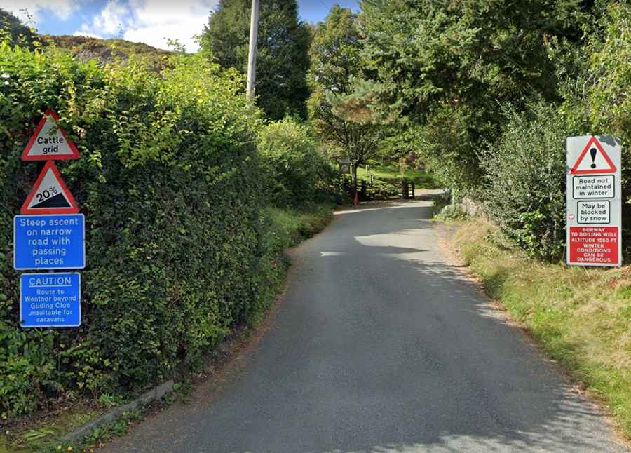
The road is pretty narrow and steep (up to 20%), so inexperienced drivers are cautioned not to drive on this road under any condition, as it is a single track. It’s certainly not for the faint-hearted. Drivers face a sheer drop down the hillside on one side, and the road is just wide enough for one car in places. It’s unsuitable for caravans. The drop overlooking the valley is quite insane with no barrier protection at all. Drivers face a sheer drop down the hillside on one side, and the road is just wide enough for one car in places. It’s a very narrow high shelf road intimidating to beginners or those not fond of heights.
How long is the Burway?
The road is 7.88km (4.9 miles) long, running east-west from Church Stretton, a market town in Shropshire, to Longmynd. On the western side, it is called The Port Way.
How steep is the Burway?
The road to the summit is very steep, reaching a 20% maximum gradient through some of the ramps. Starting at Church Stretton, this ancient route to the top is 3.24 km (2.01 miles) long. Over this distance, the elevation gain is 281 meters. The average percentage is 8.6%.
Is the Burway open?
The road is not maintained in winters. This clean tarmac, narrow road is said to be Shropshire's highest public road. In winter, deep snow can often make the road impassable. Drivers are advised not to drive the road in icy or snowy conditions. It is treacherous in poor weather and is especially dangerous in frost, ice, or snow: if you slip, you can easily go over the edge.