Things to Know Before Driving the Flooded Welney Wash Road
Located on the Norfolk Cambridgeshire border, in England, the infamous Welney Wash Road is one of the periodically flooded roads around the world.
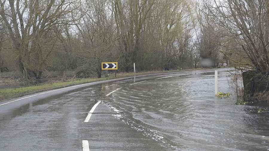
Why does Welney Wash flood?
Located in the Hundred Foot Washes area, on the eastern part of the country, the road (A1101) is totally paved and crosses the Ouse Washes Flood Storage Reservoir, creating a low point in the Middle Level Barrier Bank. When the Ouse Washes are flooded above a certain level, - in times of high rainfall further inland- the road crossings at Welney and Earith will have to be shut down. The Ouse Washes are part of a flood defence system that provides storage for floodwater that the River Great Ouse cannot discharge directly into the sea without overflowing its banks. The excess waters are held within the washes until tides and river flows allow discharge back into the river and thence the sea. This can take a few days or a several weeks. Unfortunately, this essential safety feature results in regular flooding of a section of the road.
How deep is the water at Welney wash?
The road, also known as Welney Causeway or Wash Road, is 1.28km (0.8 mile) long, running from Welney to Gold Hill. The usual range of the River Great Ouse at the causeway is between 0.46m and 2.40m. Flooding of the road starts when the water level at Welney reaches 2.40m. On 7 January 2003, the measuring station reached the highest level recorded, at 4.13m.
Is the road at Welney flooded?
Located in west Norfolk, the causeway is being improved to prevent flooding and a new temporary flood barrier is being installed, to prevent water spilling on the area, locally simply called "The Washes". The road was flooded for the most prolonged period for years, from the end of November 2006 to March 2007 with only a few dry periods in between.
Road suggested by: jorge manuel gómez sánchez
Pic&more info: https://www.facebook.com/profile.php?id=100057610862282