Get behind the wheels for Mam Tor
Mam Tor, known as "the Shivering Mountain," is a mountain pass at an elevation of 461m (1,512ft) above sea level, located in the High Peak of Derbyshire, in England.
Can you drive to Mam Tor?
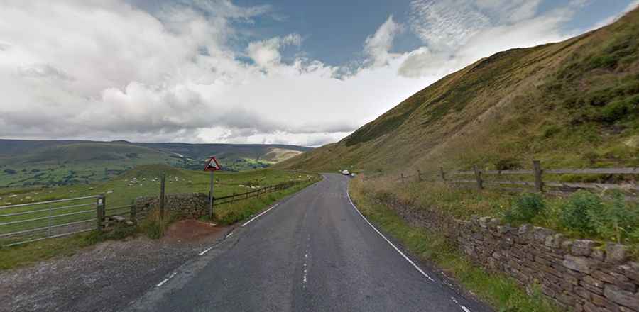
The road to the summit is entirely paved, with narrow and steep sections. It's called Mam Tor Road (part of the A625 road). The road's narrowness and its 20% (1 in 5) gradient have led to its closure to buses, coaches, and vehicles over 7.5 tons in weight. It winds through a cleft, surrounded by towering limestone pinnacles. Frequent landslips on its eastern face have resulted in a multitude of 'mini-hills' beneath it. These landslips, caused by unstable lower layers of shale, also give the hill its alternative name of Shivering Mountain.
How long is the road to Mam Tor?
The pass is 17.54km (10.9 miles) long, running west-east from Chapel-en-le-Frith to Hope. The road features regularly in the Tour of the Peak cycle race each autumn. It presents the riders with a severe challenge and often determines the race outcome. The road is very steep, with a 10% maximum gradient through some of the ramps.
Is the old road to Mam Tor still in use?
Located near Castleton, at the western end of the Hope Valley, the first road through the pass was built in 1819 to bypass the steep Winnats Pass. The former road crossed the main body of the landslide twice. Due to the local geology, the road began to subside almost as soon as it was built. Because of numerous landslides, the road saw constant repairs and reconstruction over the following 160 years. In 1977, the road was restricted to single-lane traffic. The costs of repair eventually led to the road being abandoned in 1979, and the Old Mam Tor Road was permanently closed to traffic.