The Broomway is Britain’s most deadly path
Located in Essex, in the southeastern part of England, The Broomway is said to be Britain’s most deadly path, killing more than 100 people at over 600 years old. The Broomway is exceptionally dangerous.
Where does the The Broomway start and end?
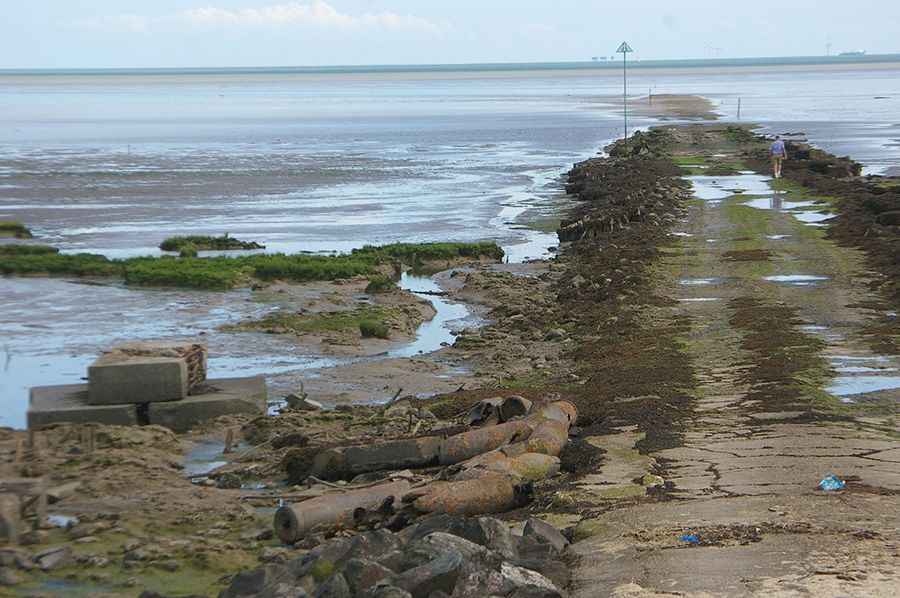
Known locally as the Black Grounds, the path is classed as a Byway Open to All Traffic. It runs for 6 miles (9.7 km) along the Maplin Sands, parallel to the Essex coastline, and when the tide is out, it provides access to Foulness Island. This path is only walkable at low tide and connects the island of Foulness with the Southend mainland at Wakering Stairs.
When was The Broomway built?
Dating back to Roman times, the path was recorded as early as 1419 and runs some 440 yards (400 m) from the present shoreline out on the sands. The route was originally marked with sticks of broom sunk into the sand to mark the safe route, which is how it acquired its name. Disorientation is a danger as well as inundation: in mist, rain or fog, it is easy to lose direction in such self-similar terrain, with shining sand extending in all directions.
How dangerous is The Broomway?
It’s one of the periodically flooded roads around the world. The path is marked with large Danger Area signs on the map and it’s said to have claimed the lives of more than 100 people. It features a danger of death by drowning or exposure - do not do this walk without understanding the very real dangers. At high tide, the perilous medieval road abruptly disappears into the sea. The tide comes in quicker than you expect, extremely fast. The path is unmarked and very hazardous to pedestrians. Even when the surface is walkable, at low tide, it’s not to be completely trusted, riddled with patches of sticky mud and quicksand and surrounded by old mines that may explode if touched.
Pic: Norman Brice