Driving the nerve-racking paved road to Killhope Cross
Killhope Cross is a mountain pass at an elevation of 629m (2,063ft) above sea level, located in England. It's one of the highest roads in the country.
Where is Killhope Cross?
Set high in the north Pennines range, on the northeastern part of the country, driving the road through the summit, you’ll pass through 3 counties in no time: Northumberland, Cumbria, and County Durham.
Why is the pass called Killhope Cross?
Across the road, at the highest point of the pass, there is a weathered carved boundary marker, in the shape of a cross, described as of uncertain date but possibly medieval.
Is Killhope Cross paved?
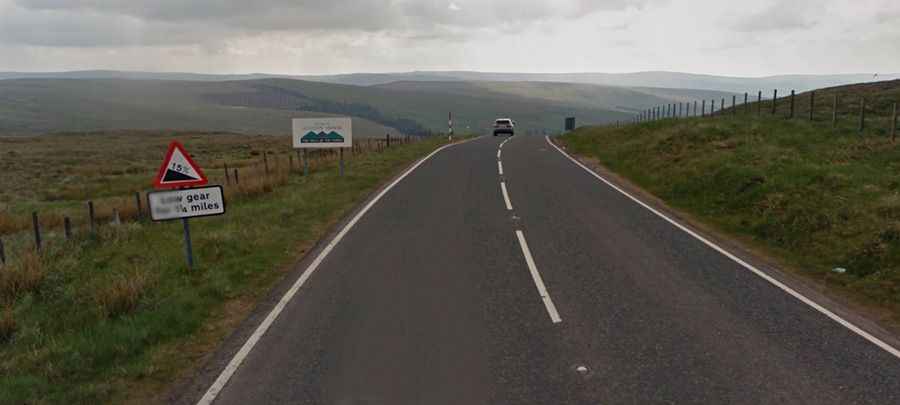
The road to the summit is totally paved, but very steep, hitting a grueling 14.3% of maximum gradient through some of the ramps. It’s called A689. High winds hit all the way up to the pass. It’s said to be the highest paved pass in England.
How long is the road through Killhope Cross?
The pass is 8.69km (5.4 miles) long, running west-east from Nenthead (one of England's highest villages in the county of Cumbria) to Cowshill (a village in County Durham at the top of Weardale). Along the way, you’ll be rewarded with panoramic views across the Pennines. The landscape around is incredibly bleak.