Driving the Låningsvejen, a tidal causeway to Mandø Island
Off the southwest coast of Jutland, in the Danish Wadden Sea, part of the North Sea, lies Mandø. This unique island, located in the middle of the Wadden Sea National Park of Denmark, remains one of the country's most peaceful retreats. Surrounded by tidal wetlands, Mandø has remained relatively untouched by mainstream tourism, thanks to its distinctive access road, which gives it the title of being Denmark's best-kept secret. It’s one of the periodically flooded roads around the world.
Mandø Island and its tidal causeway, Låningsvejen, serve as a testament to the harmony between man and nature. The journey to the island is as much a part of the adventure as the destination itself. As Låningsvejen reappears from the sea's embrace during the ebbing tide, it welcomes visitors to one of Denmark's most serene and unforgettable escapes.
Låningsvejen: The Tidal Causeway Experience
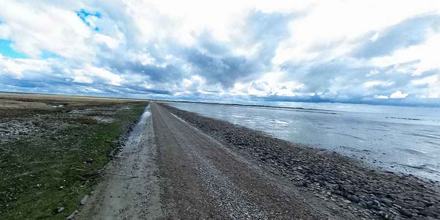
Twice a day, an ancient spectacle unfolds: the road to Mandø, known as Låningsvejen, disappears with the tides. This unpaved causeway, covered by the North Sea twice in every 24-hour period, is no more than copious gravel laid down on an immense mudflat.
Navigating the Causeway:
Stretching about four kilometers (2.5 mi) long, Låningsvejen demands careful navigation. With frequent periodic maintenance due to the wear and tear from the tides, driving here is a unique experience. It's essential to drive slowly to avoid skidding, especially on the seaweed left behind by the outgoing tide. In the case of dense fog, drivers should turn on both headlights and fog lights. The causeway's speed limit is set at 25km/h. Although suitable for conventional motor vehicles, the route may be compromised during storms at high tide.
Peak Seasons and Recommendations:
In the summertime, Låningsvejen sees heightened traffic. While the ride is a thrilling experience, it's best undertaken in dry and settled weather, making it suitable even for older children. It's always recommended to consult the tide tables before embarking on the journey.
Preservation Amidst Accessibility
While Mandø offers a historical and natural allure, its connection to the mainland of Jutland, via Låningsvejen, holds its own set of tales. Each year, tales emerge of overconfident adventurers 'risking it' against the tides, some needing rescue from the causeway's safety points. This very unpredictability has allowed Mandø to stay preserved. For those wary of taking the challenge head-on, tractor-pulled buses with oversized tires offer a safer and equally thrilling alternative.
Safety and Precautions
The ebb and flow of the tides covering Låningsvejen is not just about the road but the rhythm of nature. Thus, it's imperative to respect this rhythm by paying attention to the posted tidal notices and familiarizing oneself with the causeway opening times for the day of the visit. As the road floods with incoming tides, the slippery seaweed that's left behind serves as a natural reminder of the sea's recent embrace.
Pic: Peter Kristensen