What are the most spectacular roads in Denmark?
Part of Scandinavia and located in the northern part of Europe, Denmark covers an area of 42,943 square kilometers. It comprises the Jutland Peninsula and numerous islands.
With no big mountains, the highest road of the country leads to Ejer Bavnehoj. Located in the eastern part of Jutland, this hill rises to 170.86 meters (560.56 feet) above sea level. While the height is not impressive by international standards, it’s the country's highest point. It’s also worth the drive through the Oresund bridge, a new link between the country and Sweden. This spectacular bridge connects Amager in Denmark with Skane, in Sweden. It has a length of 10 miles (16,4 km). It's one of the most spectacular bridges in the world.
And if you like challenging experiences, don’t skip driving the tidal causeway to Mandø Island. Due to its difficult access, Mandø has remained relatively untouched by mainstream tourism. It’s one of the periodically flooded roads around the world.
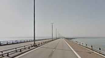
Crossing the Oresund bridge from Denmark to Sweden
Øresundsbroen is a new link between Denmark and Sweden. This spectacular bridge connects Amager in Denmark with Skane, in Sweden. It has a length of 10 miles (16,4 km). It's one of the most spectacular bridges in the world.
How to get by car to Mons Klint in Denmark?
Møns Klint is a very famous spot located on the eastern coast of the Danish island of Møn, in the Baltic Sea. It’s one of Denmark’s most popular and breathtaking landscapes.
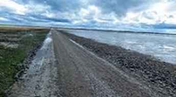
Driving the Låningsvejen, a tidal causeway to Mandø Island
Off the southwest coast of Jutland, in the Danish Wadden Sea, part of the North Sea, lies Mandø. This unique island, located in the middle of the Wadden Sea National Park of Denmark, remains one of the country's most peaceful retreats. Surrounded by tidal wetlands, Mandø has remained relatively untouched by mainstream tourism, thanks to its distinctive access road, which gives it the title of being Denmark's best-kept secret. It’s one of the periodically flooded roads around the world.
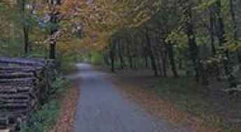
Driving the highest road of Denmark to Ejer Bavnehoj
Ejer Bavnehøj, also known as Yding Skovhøj, is the highest natural point in Denmark. Located in the eastern part of Jutland, this prominent hill rises to an elevation of 170.86 meters (560.56 feet) above sea level. While the height might not seem impressive by international standards, it holds great significance for the Danish people as it represents their country's highest point.
Discover the Hidden Island with Just One Road: A Scenic Journey Through Egholm
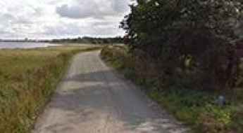
Tucked away in the middle of the Limfjord, between Aalborg and Nørresundby, a short unpaved road is the only road on the Danish island of Egholm.
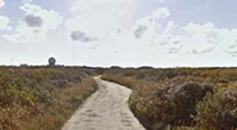
Driving to Skagen Nordstrand the northernmost road of Denmark
Skagen Nordstrand is a remote beach located at the northern tip of Denmark’s Jutland peninsula. It is the northernmost point in the country.
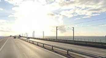
Storebælt Bridge: Driving the 18km Great Belt Fixed Link in Denmark
The Storebælt Bridge, or Great Belt Fixed Link, is a massive 18-kilometer structure connecting Nyborg on the island of Funen with Halsskov on Zealand, Denmark. The link consists of a suspension bridge (the East Bridge) and a box girder bridge (the West Bridge). The physical reality of driving this crossing involves managing extreme exposure to North Sea winds, where the road deck reaches 75 meters above sea level. This height, combined with the lack of surrounding terrain, makes the bridge one of the places on the European road network where the wind is most likely to push you out of your lane.