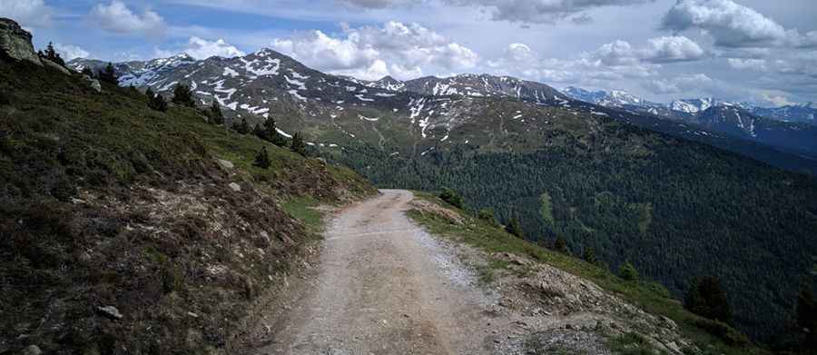
Driving the steep service road to Patscherkofel in the Tyrolean Alps
Patscherkofel is a prominent mountain peak serving as a major telecommunications and radar hub in the Austrian state of Tyrol. Reaching an elevation of 2,250m (7,381ft) above sea level, the summit is accessed via a grueling unpaved service road that overlooks the city of Innsbruck. This track is not designed for standard transit; it is a steep, technical climb through the alpine landscape where the mechanical endurance of the vehicle and the driver’s ability to manage loose gravel are tested at every turn.
| Road facts: Patscherkofel | |
|---|---|
| Location | Patsch, Tyrol (Austria) |
| Max Elevation | 2,250m (7,381ft) |
| Length | 10.9 km (6.77 miles) |
| Average Gradient | 11.28% |
How challenging is the climb from Patsch to Patscherkofel?
The journey to the summit starts in the village of Patsch and covers 10.9 kilometers of unrelenting vertical push. Over this short distance, the road gains a massive 1,230 meters in elevation, resulting in a brutal average gradient of 11.28%. This is a sustained climb that leaves no room for the engine to recover. The track is entirely unpaved, consisting of a hard-packed gravel surface that can become loose and treacherous during the dry summer months or after heavy Tyrolean rains. Navigating the 16 sharp hairpin turns requires a vehicle with significant low-end torque to maintain momentum through the steep apexes where traction is most limited.
Why is the Patscherkofel road considered a technical service track?
As seen in the technical landscape of the summit, the road serves as the primary artery for the maintenance of a large communication tower and a radar dome. Because this mountain is also a major ski destination, the road weaves between chairlifts and hiking paths. This means that while the road is wide enough for service trucks, it remains a "shared" and narrow space where you must be alert for maintenance machinery. The challenge here is the constant steepness; unlike most alpine passes, the gradient rarely drops below 10%, putting immense thermal stress on the cooling system during the ascent and requiring disciplined engine braking on the way down to avoid brake fade.
What are the weather hazards on the road to Patscherkofel?
At 2,250 meters, the Patscherkofel is fully exposed to the volatile weather of the Central Alps. The summit is often engulfed in high-velocity winds and sudden mist, which can reduce visibility on the exposed ridges to near zero. Although the road is primarily used in the summer for facility access, sudden snowfalls can occur even in the shoulder seasons, making the unpaved surface impassable for anything other than heavy-duty 4x4s or tracked vehicles. Before attempting the drive, checking the local mountain forecast is vital, as the combination of an 11% gradient and a wet or icy gravel surface makes the 16 hairpins extremely dangerous.
Is the road to Patscherkofel open to the general public?
Access to the summit road is highly restricted. Due to its status as a service track for critical infrastructure (radar and communications) and its location within a sensitive alpine ski area, private vehicle access is generally prohibited or requires special permits. Most visitors reach the summit via the Patscherkofelbahn cable car, leaving the road to the maintenance crews who handle the logistical reality of the peak. For those authorized to drive it, the route is a masterclass in alpine service road engineering, where the verticality of the terrain dictates every gear change and the technical integrity of the vehicle is the only guarantee of reaching the restaurant and the radar station at the top.
Pic: Kanon G.