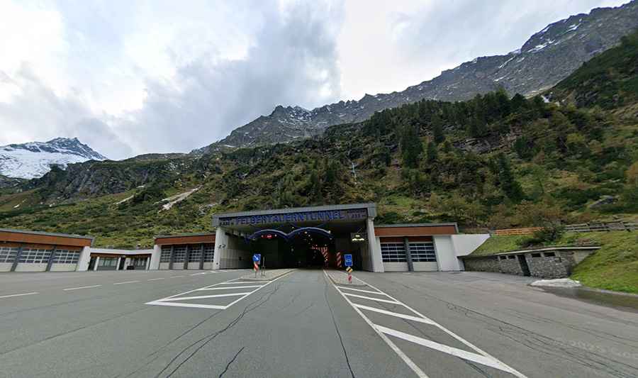
Driving Through the Felbertauern Tunnel in the Heart of the Alps
The Felbertauerntunnel is a high mountain tunnel at an elevation of 1,650m (5,413ft) above sea level, located on the border of Salzburg and Tyrol, in Austria.
Where is the Felbertauern Tunnel?
The tunnel is located in the west-central part of the country, within the Nationalpark Hohe Tauern. Before this tunnel was opened to traffic, to get from East Tyrol to the state capital Innsbruck, one had to travel either through South Tyrol or via the Großglockner High Alpine Road, which is only passable in summer.
The tunnel is named after the nearby Felbertauern Pass, which sits at around 2,481 meters (8,140 feet) above sea level.
When was the Felbertauern Tunnel built?
Completed in 1967, the tunnel is approximately 5.3 kilometers (3.3 miles) long, making it one of the longest road tunnels in Austria. It is a single-tube tunnel with two-way traffic. The tunnel is a toll road, and vehicles must pay to use it.
Is the road through Felbertauern Tunnel paved?
The road through the tunnel is totally paved. It’s called Felbertauern road (B 108). It’s protected by galleries from avalanches and rockfalls. More than one-third of the road runs through avalanche galleries and tunnels, and over half of the route is built with three lanes — a modern Alpine pass indeed. Long stretches also run over bridges, and the gradient nowhere exceeds 10%. Nevertheless, driving up to one of the tunnel portals is an experience; at the top, you can call the tunnel shuttle of the Felbertauernstraße AG to easily get to the other side.
How long is the road through Felbertauern Tunnel?
The road through the tunnel is 65 km (40 miles) long, running north-south from Mittersill (a city in the state of Salzburg) to Lienz (a medieval town in the state of Tyrol). The drive comprises steep sections and hits a 9.3% maximum gradient through some of the ramps.
Is the Felbertauern Tunnel open year-round?
Set high in the Hohe Tauern mountain range of the Alps, the tunnel is usually open all year round.