Road to Schattberg West: Driving the 20% Ski Service Track in Salzburg
Located in the Pinzgau region within the state of Salzburg, Schattberg West is a prominent mountain peak reaching an elevation of 2,087m (6,847ft) above sea level. Part of the Kitzbühel Alps, the summit is accessible via a technical ski-station service road that serves the local lift infrastructure and the Westgipfelhütte refuge.
| Road facts: Schattberg West | |
|---|---|
| Location | Salzburg, Austria |
| Elevation Gain | 1,137 m |
| Length | 10.4 km (6.46 miles) |
| Average Gradient | 10.93% |
| Max Gradient | 20% |
| Hairpin Turns | 33 |
How is the road to Schattberg West?
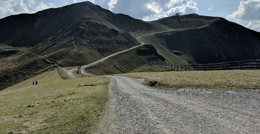
The ascent to Schattberg West starts from Igelsberg (near Saalbach). The road is 10.4 km (6.46 miles) long and remains entirely unpaved. This is a specialized chairlift access trail characterized by its extreme steepness, with a sustained average gradient of 10.93%. The track layout is highly technical, featuring 33 hairpin turns to overcome a total elevation gain of 1,137 meters. The surface consists of loose alpine stones and crushed rock, which becomes significantly more rugged and steeper in the upper sections near the 2,000m mark.
What are the driving hazards on the road to Schattberg West?
The primary hazard on the Schattberg West service road is the extreme gradient hitting 20% on several ramps. These sections require maximum torque and high-clearance 4x4 vehicles. The loose stone surface provides minimal tire friction, especially during the descent where severe brake overheating is a critical risk. High-velocity winds are constant throughout the year, and sudden snow squalls can occur even in mid-summer. The track is narrow and lacks safety barriers, meaning there is zero margin for error on the 33 switchbacks that overlook the Glemmtal valley.
When is the road to Schattberg West open?
Due to its high altitude and function as a ski area, the road to Schattberg West is only accessible during a very narrow window in the summer, typically late August, depending on the snowmelt. For the majority of the year, the track is covered in deep snow and ice, making it impassable for any motorized vehicle. Even when open, weather conditions can change in minutes, with temperatures dropping below freezing rapidly. Drivers must be self-sufficient, as the road is primarily a service corridor and not intended for general public transit.
What is the driving strategy for the 33 hairpin turns of Schattberg West?
Navigating the 10.4 km climb requires advanced mountain driving techniques. The use of low-range gearing is mandatory to maintain steady momentum on the 20% inclines and to protect the transmission from overheating. On the descent to Igelsberg, engine braking must be utilized as the primary speed control method to prevent brake fade on the sustained 10.93% slope. Monitoring tire pressure is essential to maximize traction on the rocky upper segments. Drivers should also be alert for heavy maintenance machinery and authorized service vehicles operating near the Westgipfelhütte.
Pic: Roman Mihalik