How to drive the steep 14.5% ascent to Sella Bistrizza?
Sella Bistrizza (Bistrizza-Sattel) is a high mountain pass at an elevation of 1,718 meters (5,633 ft) above sea level in the Carnic Alps, located on the border between Carinthia (Austria) and Friuli-Venezia Giulia (Italy). The 7.8-kilometer unpaved mountain route climbs out of Vorderberg up to the Oisternig massif across steep 14.5% ramps.
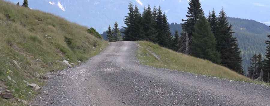
| Road facts: Sella Bistrizza | |
|---|---|
| Location | Austria (Carinthia) / Italy (Friuli-Venezia Giulia) border |
| Elevation | 1,718 m (5,633 ft) |
| Length | 7.8 km (4.84 miles) from Vorderberg |
| Elevation Gain | 1,133 vertical meters (3,717 ft) |
| Average Gradient | 14.52% |
| Maximum Gradient | 18% (on inner hairpin bends) |
| Hairpin Switchbacks | 8 turns |
| Surface | Stabilized gravel, coarse rock, and dirt track |
| Vehicle Requirement | High-clearance 4WD required for traction |
Where is Sella Bistrizza located?
The pass sits on the international ridge between Austria and Italy in the Carnic Alps. Starting from the village of Vorderberg in Carinthia, the 7.8-kilometer gravel track climbs 1,133 vertical meters to end near a mountain lodge beneath the Oisternig peak and the Madonna della Neve chapel.
Is the road to Sella Bistrizza paved?
No. The entire 7.8-kilometer climb is an unpaved, stabilized gravel track. The road surface consists of coarse crushed rock and loose stone, which causes immediate wheel spin on steep gradients for non-4WD vehicles.
How steep is the drive up Sella Bistrizza?
The climb gains 1,133 vertical meters over 7.8 kilometers, producing a sustained average gradient of 14.52%. The route includes 8 sharp hairpin turns where inner-radius ramps reach 18%, putting heavy stress on clutches, transmissions, and engine cooling systems.
What hazards exist on Sella Bistrizza?
The main physical hazards are loss of tire traction on loose gravel 14.5% slopes, narrow shelf-road widths with no guardrails, and severe risk of brake fade during the 7.8-kilometer downhill descent. Winter snow accumulation blocks the track until late spring, and summer storms cut water gullies across the roadbed.
Pic: Schotterali