Kaunertal Glacier Road: 26 km, 29 hairpin turns and 1,500 m change in elevation in the Alps
Kaunertal Glacier Road is an alpine road climbing up the Kaunertal Glacier, at 2.750m (9,022ft) above sea level. It’s the fifth highest paved road in the Alps. It covers 26 kilometers with a total of 29 bends and an altitude difference of 1,500 meters.
Where is the Kaunertal Glacier Road?
The road is located in the Landeck district in the Austrian state of Tyrol, in the southwestern part of the country, near the Italian border.
When was the Kaunertal Glacier Road built?
The road was built in 1980 to make the world of glaciers accessible to many people.
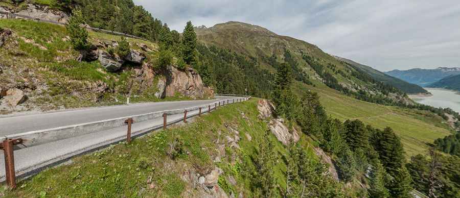
How long is the Kaunertal Glacier Road?
This winding road is fully paved and runs along the edge of the Gepatsch reservoir. It’s 26 km (16.15 miles) long, starting at the village of Feichten in the valley of the Kauner at 1,273m above sea level. With 180 turns, the road leads all the way to the base of the ski area at 2,750 m (9,020ft). At the end of the road, the new Karlesjoch cable railway takes you up to 3,108 m.
Is the Kaunertal Glacier Road steep?
The average gradient of the Kaunertaler Gletscherstraße is 10%, with a maximum gradient of 12%. Climbing up the mountain in 29 sharp hairpin turns, this cliff-hugging highway rises 1,500 meters from 1,273m to 2,750m.
Is the Kaunertal Glacier Road worth it?
It’s one of the scenic Austrian Alpine roads. The road seems to leave the earth behind. It’s impressive for its engineering as for its stunning vistas. The toll is only charged to non-skiers. All skiers with a valid ski pass can use the toll road free of charge. Along the road, 29 information panels reveal details about the area’s nature, history, and culture. Plan about 50 minutes to complete the drive.
Is Kaunertal Glacier Road open?
The glacier road is open in June, July, and August, from 7 am to 7:30 pm. In all other months, the road is open from 7 am to 5 pm.
Pic: Stefan Heinicke