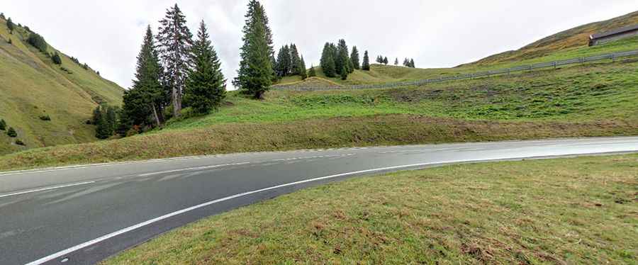
A curvy road to Hochtannberg Pass in the Austrian Alps
Hochtannberg Pass is a high mountain pass at an elevation of 1,676 m (5,499 ft) above sea level, located in the westernmost Austrian state of Vorarlberg. It separates the Allgäu Alps from the Lechquellen Mountains and connects the Hochtannberg region and the Lech Valley near Warth with the Bregenzer Ach Valley near Schoppernau. The pass is also part of the European main watershed, with its lowest point at 1,660 m. In the relatively flat pass area lie Lake Kalbele (Kalbelesee) and, a bit southwest, Lake Körber (Körbersee).
Where is Hochtannberg Pass?
The pass is located in the western part of Austria, near the German border, linking the Allgäu Alps to the headwaters of the Lech River. At the summit, there are two parking lots, a cable car station, and some buildings. The pass summit sign is located exactly between the two parking lots.
Is Hochtannberg Pass paved?
The road through the pass is fully paved. It’s called Bregenzerwaldstraße (Federal Highway B 200). The route comprises many turns and steep sections, reaching a maximum gradient of 14% on some ramps.
How long is Hochtannberg Pass?
The pass is 10 km (6.21 miles) long, running west-east from Schröcken to Warth. Since 2007, the road has been modernized following a landslide near the summit that severely damaged it about five years earlier, necessitating repairs and expansion.
The old western ramp between Schröcken and Neßlegg, once featuring extremely tight hairpin bends and steep inclines, was later replaced by a completely redesigned three-kilometer-long section with tunnels and eight bridges (totaling 715 meters) to make it safer in winter.
Parallel to and south of the current pass road runs the “Old Salt Road”, a historic pack trail leading east from the summit into the Lech Valley toward Warth, still used today as a hiking route. North of the pass road, another hiking trail continues beyond Warth toward Gehren.
Since the 15th and 16th centuries, the pass (also known as Hochkrumbach Saddle) has been used by travelers and the Walser people to reach the Lech Valley or the Kleinwalsertal, crossing the nearby Gemstel Pass (1,971 m). In the late Middle Ages, a chapel and an inn were established near the pass, forming the core of the present-day settlement of Hochkrumbach.
How challenging is the road to Hochtannberg Pass?
The route features many curves, steep ramps, and scenic alpine sections. While the modern road is fully paved, the tight hairpins of the old western ramp have been replaced, which has somewhat reduced the driving thrill, especially for motorcyclists.
Is Hochtannberg Pass open?
Set high in the Alps, the road is usually open year-round. Short-term closures may occur in winter due to weather or snow conditions.