Passo Stalle: Driving the narrow border road between Italy and Austria
Passo Stalle (also known as Staller Saddle) is an international high mountain pass at an elevation of 2,061m (6,761ft) above sea level, located on the border between Austria and Italy. This alpine crossing links the Defereggen Valley in East Tyrol (Austria) with the Valle di Anterselva in South Tyrol (Italy), offering a unique driving experience through the High Tauern range.
The road is fully paved and well-marked, but its extreme narrowness on the Italian side makes it one of the most technical passes in the Alps. Because the track is too tight for two vehicles to pass each other, traffic is strictly regulated by a synchronized one-way system controlled by traffic lights.
| Road facts: Passo Stalle / Staller Saddle | |
|---|---|
| Elevation | 2,061m (6,761ft) |
| Max Gradient | 12% |
| Road Names | L25 (Austria) / SP44 (Italy) |
| Access Window | May to October (Closed at night) |
| Restrictions | No caravans, trucks, or buses |
How do the traffic lights work at Passo Stalle?
Due to the restricted width of the SP44 road on the Italian side, driving is regulated by a strict schedule. From the Austrian side (top of the pass), the traffic light turns green during the first 15 minutes of every hour (e.g., 10:00 to 10:15). From the Italian side (Anterselva lake), the light turns green from the 30th to the 45th minute of every hour (e.g., 10:30 to 10:45). Overtaking is impossible, and driving against the red light is extremely dangerous as there is no room to maneuver.
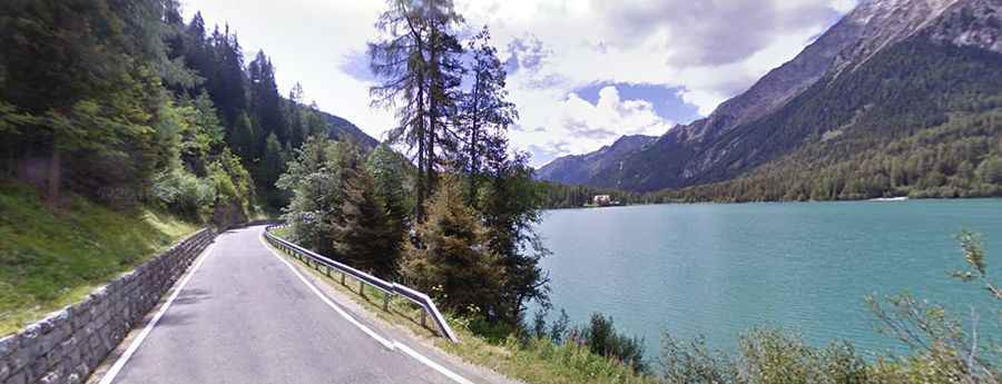
What is the road like on the Italian side (SP44)?
On the Italian side, the road is designated as Strada Provinciale 44. It is notoriously narrow, with several blind corners and steep ramps hitting an 11% gradient. It is strictly prohibited for caravans, buses, and vehicles exceeding 3.5 tons. In some sections, the pavement is so tight that a car may struggle even to pass a cyclist. The route is open only from May to October, specifically between 05:30 and 22:15. Outside these hours, the pass is closed for the night.
What is the road like on the Austrian side (L25)?
The Austrian approach via the L25 road is generally wider and less steep than its Italian counterpart. However, after passing the last village, Erlsbach (1,549m), the gradient increases. For a few kilometers, drivers will face steady inclines of 8% with specific ramps hitting 12%. A practical tip for travelers: fuel is often significantly cheaper in Austria than in Italy (sometimes up to 40%). The last fuel station before the border is located in St. Jakob in Defereggen, about 14 km from the summit.
Is Passo Stalle a dangerous drive?
While the road surface is in good condition, the danger lies in the lack of space and the strict timing. The 45-minute wait for a green light can lead some drivers to take risks, but the "dead corners" on the Italian descent leave no room for error. In case of heavy rain or landslide risks, the authorities may close the pass temporarily even during the summer season.
Road suggested by: Michael Spannlang