An old military road to Marchkinkele - Cometto di Confine
Marchkinkele - Cometto di Confine is a high mountain peak at an elevation of 2,545m (8,349ft) above sea level, located on the border between Austria and Italy. It's one of the highest roads in the country.
Where is Marchkinkele - Cometto di Confine?
The summit, also known as Markinkele and Marchginggele, is located on the border between the Autonomous Province of Bolzano in South Tyrol (northern Italy) and the district of Lienz in the Austrian state of Tyrol, within the Tre Cime Natural Park.
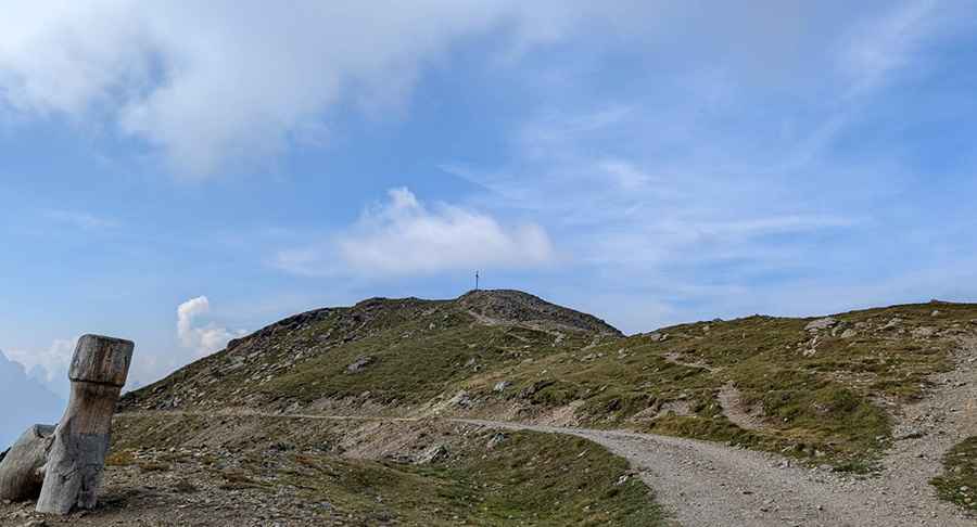
What’s on the summit of Marchkinkele - Cometto di Confine?
At the summit, there’s a mountain hut known as Marchhütte. The Rifugio Marchhütte hut is situated on the sunny side, only a few meters below the summit of the Cornetto di Confine / Marchkinkele, with a magnificent view of the Sesto and Braies Dolomites. In the 1930s, three buildings were built on the Marchkinkele as part of the Vallo Alpino del Littorio to give shelter to border guards. At the same time, the military road to the summit was created. At the summit, and along the road, there are several military constructions.
How long is the road to Marchkinkele - Cometto di Confine?
On the Italian side, the road to the summit is totally unpaved. It’s not an easy drive, for 4x4 vehicles only. It’s an old military road, that comprises narrow parts, big loose rocks, and steep sections. Starting from Innichen, or San Candido, the road is about 20km (12 miles) long. On the Austrian side, it’s just a walking path.
Is the road to Marchkinkele - Cometto di Confine open in winter?
Marchkinkele - Cometto di Confine is the southernmost peak of the Villgraten Mountains, in the Dolomites. At this elevation, the road is usually impassable in winters.
Pic: rudi piccin