Pic del Maià: Driving the 2.6km Gravel Track in Andorra
Pic del Maià is a high mountain summit at an elevation of 2,619m (8,592ft) above sea level located in the Encamp parish of Andorra, near the French border. It is one of the highest roads in the country, providing access to a major communication tower on the peak.
| Road facts: Pic del Maià | |
|---|---|
| Location | Encamp, Andorra |
| Elevation | 2,619 m (8,592 ft) |
| Length | 2.6 km (1.6 miles) |
| Avg Gradient | 8.11% |
| Surface | Unpaved / Gravel |
How long is the road to Pic del Maià?
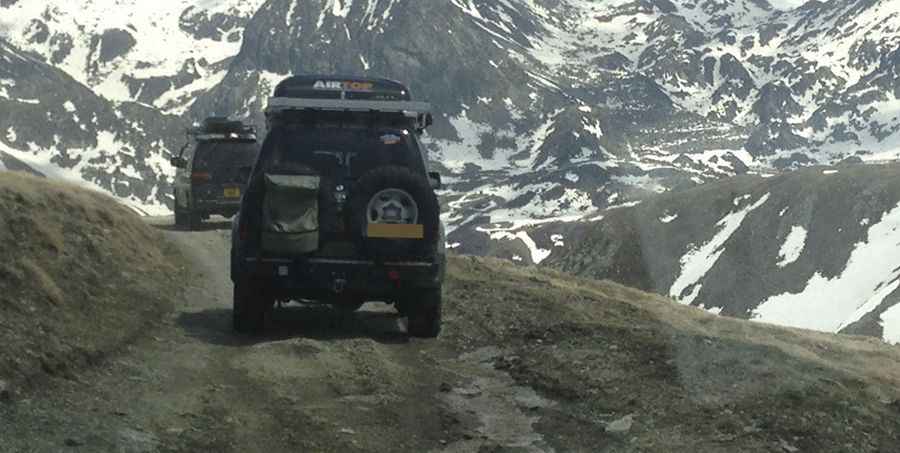
The ascent starts at Port d'Envalira and covers 2.6 km (1.6 miles). It is a steep gravel road with 7 sharp hairpin turns. With an elevation gain of 211 meters, the track has an average gradient of 8.11%.
Is the road to Pic del Maià unpaved?
The surface is very bumpy and consists of loose rock and high-altitude soil. A 4WD vehicle is required to maintain traction, as the steep ramps often have deep ruts caused by erosion. The road is very narrow, and meeting another vehicle on the hairpins requires one driver to back up on a loose, unstable surface.
Can you drive to Pic del Maià in winter?
Due to its altitude of 2,619m, the road is impassable for most of the year. Heavy snow and ice block the track from late autumn until early summer. Even in July, you might find small snow patches on the shaded parts of the hairpins. After rainfall, the dirt sections become extremely slippery. The summit is exposed to extreme winds and rapid weather changes; lightning is a major risk if a storm moves in while you are at the communication tower.
Pic: Keith Howell