How to drive the unpaved track to Collada del Sarset?
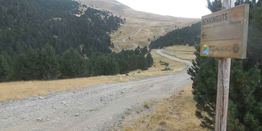
Collada del Sarset is an international mountain pass at an elevation of 2,126 meters (6,975 ft) above sea level, located right on the border ridge between Spain and Andorra. Connecting the village of Bescaran in Lleida with Juberri in the Andorran parish of Sant Julià de Lòria, the route is a rough, unpaved border track with tight switchbacks, sharp slate stones, and deep dirt ruts.
| Road facts: Collada del Sarset | |
|---|---|
| Location | Spain (Bescaran) - Andorra (Juberri) |
| Elevation | 2,126 m (6,975 ft) |
| Length | 19.4 km (12.05 miles) |
| Surface | Unpaved dirt and loose slate gravel |
| Vehicle Required | High-clearance 4x4 with low-range gears |
Where does the unpaved track over Collada del Sarset run?
The single-lane dirt route stretches for 19.4 kilometers across the Pyrenean border ridge. Starting from Bescaran in the Alt Urgell region, the track climbs steeply through a series of 15 narrow hairpins before reaching the open pastures at the 2,126-meter summit. The pass runs directly south of the paved slopes of Alt de la Rabassa, serving as one of the remote dirt crossings included among the highest roads of Andorra. The track completely lacks asphalt and drops down into the Andorran side toward Juberri.
Why do 4x4 trucks struggle on the Bescaran switchbacks?
The climb from the Spanish side consists of loose gravel and sharp alpine slate sections that easily slice tire sidewalls. The 15 hairpin turns are tightly packed and narrow; long-wheelbase trucks and large SUVs cannot clear them in a single turn, forcing drivers to shift into reverse on uneven dirt right next to unprotected drops. The steep, unmaintained ramps feature deep ruts carved by water erosion. Climbing these dirt slopes requires a high-clearance 4x4 with a low-range gearbox to maintain constant traction and keep the clutch from burning out on the sustained mountain gradients.
How do winter and mountain storms change the Collada del Sarset crossing?
Due to its high altitude of over 2,100 meters, the entire international pass is buried under heavy snowdrifts throughout the winter and early spring, making the route completely impassable for standard vehicles. When the snow melts, the water leaves deep transverse gullies across the lane and brings down loose rocks from the upper banks. Sudden mountain thunderstorms turn the dry clay sections into a slick mud trap where tires lose all lateral grip, while the absolute lack of mechanical garages or telephone coverage leaves drivers isolated if a sharp rock strikes the oil pan or damages the vehicle undercarriage.
Pic: http://www.pirineos3000.com/servlet/DescripcionAscension/MONTANA--Pic%20Negre%20de%20Claror--IDASCENSION--26176.html