How to drive the 4x4 track to Coll de Finestres?
Coll de Finestres is an international high mountain pass at an elevation of 2,392m (7,847ft) above sea level, located on the border between Sant Julià de Lòria (Andorra) and Lleida (Spain). Situated in the southern sector of the Rabassa massif, the unpaved track connects with the nearby Coll de Pimés.
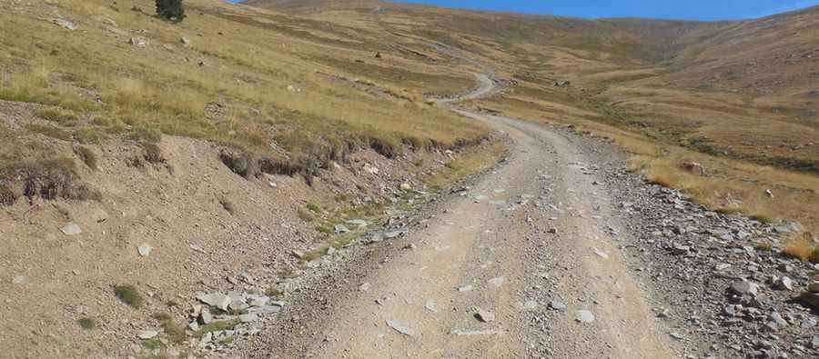
| Road facts: Coll de Finestres | |
|---|---|
| Location | Sant Julià de Lòria (Andorra) / Lleida (Spain) |
| Elevation at Summit | 2,392 m (7,847 ft) |
| Length | 2.4 km (1.49 miles) from Coll de Pimés |
| Average Gradient | 11.75% |
| Surface | 100% unpaved (dirt, loose stones, schist) |
| Vehicle Requirements | High-clearance 4x4 mandatory |
Where is Coll de Finestres located?
The pass sits on the Pyrenean border dividing southern Andorra from Catalonia. The 2.4 km track climbs from Coll de Pimés up to the border ridge at 2,392 meters altitude.
Is the road to Coll de Finestres paved?
No. The entire climb is unpaved, consisting of high-altitude soil, loose gravel, and sharp schist rocks. The track features no pavement or guardrails along the upper border sector.
Is a 4x4 required to reach Coll de Finestres?
Yes. A high-clearance 4x4 is mandatory. Climbing 282 vertical meters over just 2.4 km yields a steep average gradient of 11.75%, requiring low-range four-wheel drive to maintain traction without spinning wheels on loose stone ramps.
How challenging is driving the track to Coll de Finestres?
The ascent demands constant momentum management on steep dirt slopes. Thin air at nearly 2,400 meters reduces engine power while increasing thermal load. On the descent back to Coll de Pimés, engine braking is required to prevent foot brakes from overheating on the continuous 11.75% decline. It's one of the highest roads in the country.
Is Coll de Finestres open year-round?
No. Heavy snow accumulation leaves the pass impassable for most of the year, with snowbanks often persisting into late June. The track is unplowed and exposed to severe mountain weather, sudden storms, and high ridge winds.
Pic: http://www.pirineos3000.com/servlet/DescripcionAscension/MONTANA--Pic%20Negre%20de%20Claror--IDASCENSION--26176.html