Pic de Monturull: Driving the 1,151m climb on the Andorra-Spain border
Reaching an elevation of 2,228m (7,309ft) above sea level, Pic de Monturull (also known as Torre dels Soldats) is a prominent international high mountain peak situated on the border between Spain and Andorra. This high-altitude crossing links the Alt Urgell comarca in Catalonia with the parish of Sant Julià de Lòria in Andorra, offering one of the most sustained off-road climbs in the eastern Pyrenees. It's one of the highest roads in the country.
| Road facts: Pic de Monturull | |
|---|---|
| Location | Spain-Andorra Border (Alt Urgell / Sant Julià) |
| Elevation | 2,228 m (7,309 ft) |
| Length | 18.7 km (11.6 miles) |
| Elevation Gain | 1,151 m |
| Average Gradient | 6.15% |
Where is Pic de Monturull?
The peak is nestled within the rugged Pyrenees mountain range, serving as a natural boundary between Spanish and Andorran territories. The route is steeped in history; it is an old military road used for decades to patrol the frontier. Near the summit, you can still find several military facilities and ruins, including old barracks and observation posts that were once vital for border surveillance. Today, these stone structures stand as silent witnesses to the strategic importance of this high-altitude pass.
Is the road to Pic de Monturull unpaved?
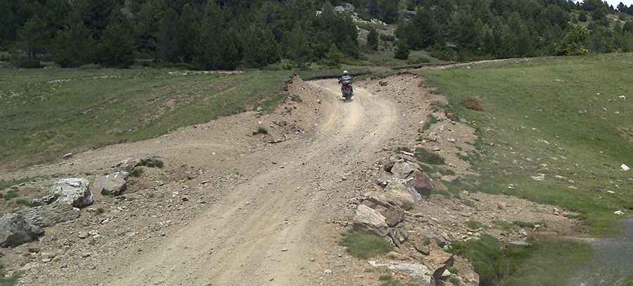
Yes, the road to the summit is totally unpaved. It consists of a long, technical track characterized by loose gravel, shale, and sections of natural rock. This is a great trail for experienced wheelers, but you should avoid driving in this area if unpaved mountain roads aren't your strong point. A high-clearance 4x4 vehicle is strictly required to navigate the uneven terrain and the sharp gradients. The track is narrow and exposed, winding through high Alpine meadows and rocky ridges where any steering error can be costly.
How long is the road to Pic de Monturull?
Starting from the village of Aubinyà in Andorra, the road to the summit is 18.7 km (11.6 miles) long. This is an epic endurance climb that tackles a massive elevation gain of 1,151 meters. With an average gradient of 6.15%, the ascent is relentless and features 15 sharp hairpin turns that snake up the massif. Each hairpin requires careful throttle management to maintain traction on the loose surface. The sheer length of the climb means you must ensure your vehicle is in top mechanical condition and has a full tank of fuel before leaving the valley.
Is the road to Pic de Monturull open in winter?
Due to its high elevation exceeding 2,200 meters, the road is usually impassable from October to June. Heavy snowdrifts and ice accumulation make the track dangerous and inaccessible for most of the year. Even during the summer, mountain storms can turn the dry shale into a slippery mud slide in a matter of minutes. Given its isolation and the technical nature of the climb, always check the local weather forecast for both the Alt Urgell and Sant Julià de Lòria before attempting this high-mountain crossing.
Pic: grizzly.at