What are the most spectacular roads in Andorra?
Set high in the eastern Pyrenees, between France and Spain, Andorra is a small country covering an area of 468 square kilometers. It is located in the southwestern part of Europe.
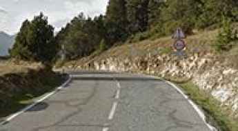
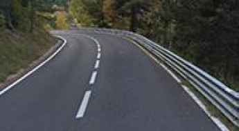
With an average elevation of 1,996 meters (6,549 ft), Andorra hosts numerous mountain roads, both paved and unpaved. When traveling there, don’t forget to climb Port d'Envalira, the highest paved road in the Pyrenees, topping out at 2,408m (7,900ft) above sea level. A drive to the top of Pic Negre is worth the drive, as the summit is on the Andorran-Spanish border, at 2.643m (8,671ft) above sea level. Also serving as a border between both countries, Port de Cabus sits at 2,308m (7,572ft) above sea level. If you prefer paved roads, don’t miss Coll d'Ordino, a 5-star road. Located in the parish of Ordino, the pass is at 1.981m (6,499ft) above sea level.
And don't forget to check out our content about the highest roads of Andorra, for those seeking the most spectacular drives. Remember the climate in Andorra varies depending on altitude, with warm summers and cold winters, so plan accordingly when driving on mountain roads. On winters, the highest roads of the country may be impassable.
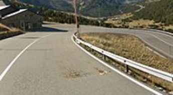
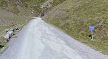
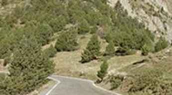
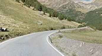
Port d'Envalira is the highest paved road in the Pyrenees
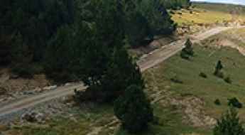
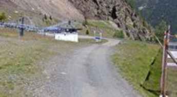
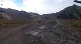
Port d'Envalira is a high mountain pass at an elevation of 2.408m (7,900ft) above sea level located in the Encamp parish of Andorra. It’s one of the highest roads in the country.
What are the highest roads in Andorra?
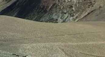
The Principality of Andorra is situated entirely within the rugged Eastern Pyrenees, a small landlocked country located between France and Spain. Defined by its extremely high elevation, Andorra has an average altitude of 1,996 metres (6,549 ft), placing it among Europe's highest nations. Even the capital, Andorra la Vella, is Europe's highest, sitting at 1,023 metres (3,356 ft). This mountainous terrain offers a concentrated network of high-altitude routes. This list details the country's highest roads, comprising both paved mountain passes and demanding, unpaved tracks that push towards the highest points of the country.
Travel guide to the top of Pic Negre
Pic Negre is an international high mountain peak at an elevation of 2.643m (8,671ft) above sea level, located on the Andorran-Spanish border. It's one of the highest roads in the country.
Driving the wild road to Port de Cabus in the Pyrenees
Port de Cabús is an international high mountain pass at an elevation of 2,308 meters (7,572 feet) above sea level, located on the Andorran-Spanish border. It's one of the highest roads in the country.
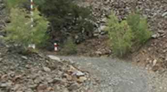
Road trip guide: Conquering Port de Rat
Port de Rat is an international high mountain pass at an elevation of 2.372m (7,782ft) above sea level, located on the border of France and Andorra. It's one of the highest roads of the country.
Coll d'Ordino is a 5-star road in Andorra
Coll d'Ordino is a high mountain pass at an elevation of 1,981m (6,499ft) above sea level, located in Andorra.
Driving Hairpin After Hairpin to Collada de la Gallina
Collada de la Gallina is an international high mountain pass at an elevation of 1,912m (6,272ft) above sea level, located on the border between Spain and Andorra. It is a very demanding climb.
The Hairpinned Road to the Summit of Collada de Beixalis
Collada de Beixalis is a high mountain pass at an elevation of 1,806m (5,925ft) above sea level, located in Andorra.
A memorable road trip to Coll de Pimes in the Pyrenees
Coll de Pimés is an international high mountain pass at an elevation of 2,136m (7,007ft) above sea level, located on the border of Andorra and Spain. It’s one of the highest roads in the country.
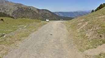
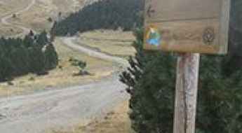
The road to Pla de l’Estany is closed to private vehicles
Pla de l’Estany is a high mountain plateau at an elevation of 2,026m (6,646ft) above sea level, located in La Massana, in Andorra.
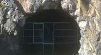
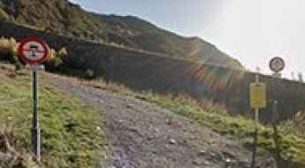
A Road That Never Was: The Abandoned Port de Rat Tunnel Between Andorra and France in the Pyrenees
Set high in the Pyrenees mountain range, the Port de Rat Tunnel is an unfinished high-mountain tunnel that was intended to connect Andorra and France.
The road to Pic de Carroi is not for the faint of heart
Pic de Carroi is a high mountain peak at an elevation of 2,265m (7,431ft) above sea level, located in Andorra. It’s one of the highest roads in the country.
A sensational paved road to Coll de la Botella
Coll de la Botella is a high mountain pass at an elevation of 2.082m (6,830ft) above sea level, located in the parish of La Massana, in Andorra.
How to drive the breathtaking road to Pic Blanc d’Envalira in Encamp?
Pic Blanc d’Envalira is a high mountain peak at an elevation of 2,665m (8,743ft) above sea level, located in the Encamp parish of Andorra. It’s one of the highest roads in the country.
A Steep Paved Road to Arinsal Ski Resort in the Pyrenees
Arinsal is a ski resort at an elevation of 1,922 m (6,305 ft) above sea level, located in the parish of La Massana, in the Principality of Andorra.
How to drive the steep paved road to Alt de la Rabassa in Sant Julià de Lòria?
Alt de la Rabassa is a high mountain pass at an elevation of 2.040m (6,692ft) above sea level, located in Sant Julià de Lòria, one of the parishes of Andorra.
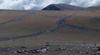
How to drive the 15% gradient to Collada de Port Negre?
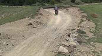
Collada de Port Negre is an international high mountain pass at an elevation of 2,505m (8,218ft) above sea level, situated on the border between Spain and Andorra. This high-altitude peak links Les Valls de Valira in Spain with Sant Julià de Lòria in Andorra. The road to the summit is a technical unpaved trail used primarily for chairlift access within the Pal-Arinsal ski resort. With an extreme vertical profile and a loose surface, it is considered one of the highest and most demanding tracks in the Pyrenees. It’s one of the highest roads in the country.
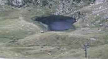
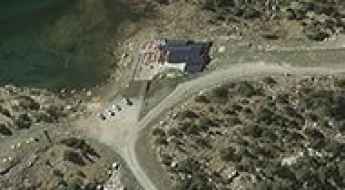
An iconic paved road to Llac d'Engolasters
Llac d'Engolasters is a high-mountain lake at an elevation of 1.616m (5,302ft) above sea level, located in Andorra.
Pic de Cubil
Pic de Cubil is a high mountain peak at an elevation of 2.499m (8,198ft) above the sea level, located in the parish of Encamp, in Andorra.
Els Cortals d’Encamp: Driving the brutal 12.5% climb in Andorra
Els Cortals d’Encamp is a high mountain pass at an elevation of 2,068 meters (6,784 ft) above sea level, located in the Encamp parish of Andorra. The road to the summit, known as the Carretera dels Cortals d’Encamp (CS-210), is a technical and punishing climb that scales the steep slopes of the Valira d'Orient valley. The physical reality of this route involves managing a sustained high-altitude ascent with ramps that hit 12.5%, where the narrowness of the asphalt and the continuous sequence of 14 hairpin turns test the vehicle's cooling system and braking endurance.
A memorable road trip to Pic d’Encampadana
Pic d’Encampadana is a high mountain peak at an elevation of 2.494m (8,182ft) above the sea level, located on the Canillo and Encamp border, in Andorra. It’s one of the highest roads of the country.
Pic de Claror
Pic de Claror is a high mountain pass at an elevation of 2.622m (8,602ft) above the sea level, located in the parish of Sant Julià de Lòria, in Andorra.
Tossal de la Llosada
Tossal de la Llosada is a high mountain peak at an elevation of 2.541m (8,336ft) above the sea level, located on the Canillo and Encamp border, in Andorra.
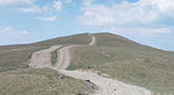
Pic del Maià: Driving the 2.6km Gravel Track in Andorra
Pic del Maià is a high mountain summit at an elevation of 2,619m (8,592ft) above sea level located in the Encamp parish of Andorra, near the French border. It is one of the highest roads in the country, providing access to a major communication tower on the peak.
How to drive the 4x4 track to Coll de Finestres?
Coll de Finestres is an international high mountain pass at an elevation of 2,392m (7,847ft) above sea level, located on the border between Andorra (Sant Julià de Lòria) and Spain (Lleida). Logistically, it is one of the highest driveable points in the Pyrenees, situated in the southern sector of the Rabassa massif. The route demands high-altitude driving experience and a vehicle specifically prepared for degraded mountain tracks.
Driving the wild paved road to Coma de Ransol
Coma de Ransol is a high mountain peak at an elevation of 1.932m (6,338ft) in the parish of Canillo, in Andorra.
Pic de la Peguera
Pic de la Peguera is a high mountain pass at an elevation of 2.577m (8,454ft) above the sea level, located in the parish of Sant Julià de Lòria, in Andorra.
Collada de Prat Primer
Collada de Prat Primer is a high mountain pass at an elevation of 2.607m (8,553ft) above the sea level, located in the parish of Sant Julià de Lòria, in Andorra.
How to drive the unpaved track to Collada del Sarset?
Collada del Sarset is an international mountain pass at an elevation of 2,126 meters (6,975 ft) above sea level, located right on the border ridge between Spain and Andorra. Connecting the village of Bescaran in Lleida with Juberri in the Andorran parish of Sant Julià de Lòria, the route is a rough, unpaved border track with tight switchbacks, sharp slate stones, and deep dirt ruts.
How steep is the 4x4 track to Estany de Coma Estremera in Andorra?
Estany de Coma Estremera is a high mountain lake reaching an elevation of 2,384m (7,821ft) above sea level in the parish of Encamp, Andorra. Located in the rugged Grau Roig sector of the Pyrenees, the road to the lake is one of the highest roads of Andorra. This is a brutal, unpaved service track used by ski resort crews, where the extreme incline and the loose granite surface make it one of the most demanding short climbs in the country.
How to drive the unpaved road to Estany Primer de Pessons?
Estany Primer de Pessons is a high mountain lake at an elevation of 2.294m (7,526ft) above sea level, located in the parish of Encamp, in Andorra. It’s one of the highest roads in the country.
How to drive the unpaved road to Refugi Les Portelles in Ordino?
Refugi Les Portelles is a high mountain refuge and restaurant at an elevation of 2.568m (8,425ft) above sea level, in the parish of Ordino, Andorra. It's one of the highest roads in the country.
Pic de Monturull: Driving the 1,151m climb on the Andorra-Spain border
Reaching an elevation of 2,228m (7,309ft) above sea level, Pic de Monturull (also known as Torre dels Soldats) is a prominent international high mountain peak situated on the border between Spain and Andorra. This high-altitude crossing links the Alt Urgell comarca in Catalonia with the parish of Sant Julià de Lòria in Andorra, offering one of the most sustained off-road climbs in the eastern Pyrenees. It's one of the highest roads in the country.

Roc del Quer
Roc del Quer (also known as Cap del Quer) is a high mountain pass at an elevation of 1.956m (6,417ft) above the sea level, in Andorra, located in the parish of Canillo in the north of the country near the French border.It’s a view you will never forget. The average gradient is 6.56%.
Refugi Borda de Sorteny
Refugi Borda de Sorteny is a high mountain refuge at an elevation of 1.965m (6,446ft) above the sea level, located in the parish of Ordino, Andorra.
Coll dels Isards: Driving the steep 15% ski track between Andorra and France
Reaching an elevation of 2,590m (8,497ft) above sea level, Coll dels Isards is an international high mountain pass situated on the rugged border between France and Andorra. Located in the heart of the Pyrenees, this pass is a high-altitude frontier where the terrain is dominated by granite peaks and the extreme verticality of the Grandvalira ski domain. It’s one of the highest roads in the country.