Driving the T2709 to Baidarsky Pass: Crimea’s historic cliff road
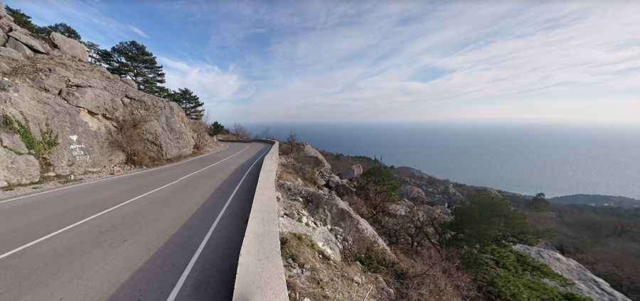
Baidarsky Pass (Baydar Gate) is a mountain pass at an elevation of 503 meters (1,650 ft) above sea level in the southwestern Crimean Mountains. Carried by the paved T2709 road (Old Sevastopol-Yalta Highway), the historic route clings to limestone cliffs overlooking the Black Sea coast.
| Road facts: Baidarsky Pass | |
|---|---|
| Location | Honcharne to Foros, Crimean Mountains (Crimea) |
| Elevation | 503 m (1,650 ft) |
| Road Name | T2709 (Old Sevastopol-Yalta Road) |
| Length | 38.8 km (24.10 miles) |
| Surface | Paved asphalt (Narrow, historic paving) |
Where is the T2709 road through Baidarsky Pass located?
The T2709 road spans 38.8 kilometers across the Crimean Mountains, running parallel above the modern H19 highway. It links coastal settlements near Foros and Alupka with the inland Baidar Valley near Honcharne.
Is the road through Baidarsky Pass paved?
Yes. The T2709 is fully paved with asphalt, but the surface is narrow, worn, and slick in wet conditions. Constructed in the 1830s, the road lacks modern engineering standards, featuring sharp switchbacks and minimal guardrail protection along vertical cliff drops.
How long is the road through Baidarsky Pass?
The entire T2709 route across the pass is 38.8 kilometers (24.10 miles) long from its coastal junction near Foros to the Baidar Valley floor.
What hazards exist on the Baidarsky Pass route?
The narrow path clings to the Kyzyl-Kaya (Red Rock) cliff face, where falling rock debris frequently litters the asphalt. Dense coastal fog reduces visibility without warning, and steep descents require lower gears to prevent brake overheating. Low concrete parapets offer little safety against steep coastal drop-offs.
Is Baidarsky Pass open in winter?
The road remains open year-round, but winter storms bring ice, freezing rain, and snow across the 503-meter summit, creating dangerous driving conditions on the steep, unbarrier-protected switchbacks.
Pic: Владимир Сластихин