Kralova hola is the highest paved road in Slovakia
Kráľova hoľa (King's Hill) is a high mountain peak at an elevation of 1,934m (6,345ft) above sea level, located in Slovakia. It’s the highest road in the country, but closed to private vehicles.
Where is Kráľova Hoľa?
The peak is located in Brezno District, in the Banská Bystrica Region, in the central part of the country.
Is the road to Kráľova Hoľa paved?
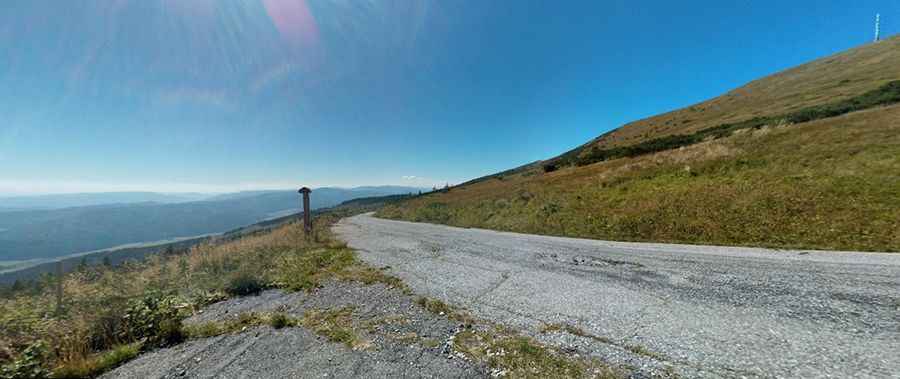
Set high on the eastern part of the Low Tatras range, the road to the summit is totally paved, but the conditions of the road worsen every year.
How long is the road to Kráľova Hoľa?
Starting at Sumiac, the road is 11.9 km (7.39 miles) long. Over this distance, the elevation gain is 1,031 meters. The average gradient is 8.66%. The road is very steep, hitting a 12% maximum gradient through some of the ramps.
Can I drive my car to Kráľova Hoľa?
The summit hosts a TV transmitter built in 1960, a weather station, and a station of the mountain rescue service. There's a panoramic view of Spiš, the Tatras, Liptov, and the Upper Hron Valley. This road is closed to motor vehicles, except for the mountain rescue service and maintenance workers of the TV transmitter on the summit.
Pic: Jakub Handzuš