Is the Road R467 from Rudo to Brodar safe for driving?
The Road R467, specifically the sector connecting Rudo and Brodar in southeastern Bosnia and Herzegovina (Republika Srpska), is a high-risk transit corridor carved into the Lim River canyon. Logistically, this 26.3 km stretch serves as a secondary link to the M5 highway, but technically, it presents extreme driving conditions due to its aging infrastructure and complex geological setting.
| Road facts: R467 (Rudo - Brodar) | |
|---|---|
| Location | Lim River Canyon, Bosnia & Herzegovina |
| Length | 26.3 km (16.3 miles) |
| Infrastructure | 17 unlit tunnels / Multiple bridges |
| Surface | Paved (uneven) |
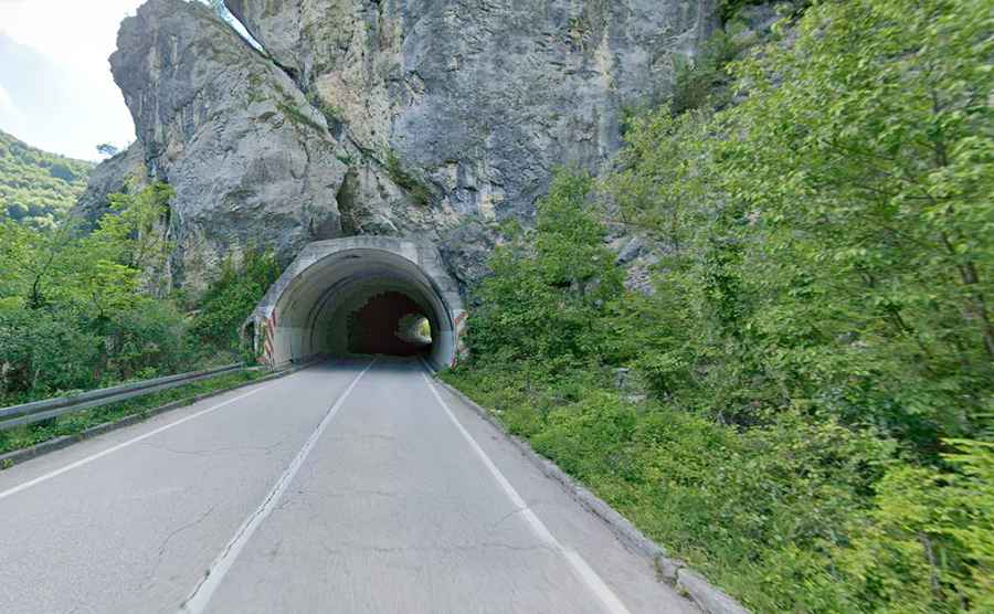
What are the technical hazards of the tunnels on Road R467?
The defining technical feature of the Road R467 is the sequence of 17 tunnels integrated into the canyon wall. Logistically, these galleries are extremely hazardous because they are entirely unlit and lack ventilation systems. Technically, most tunnels feature internal curves, which significantly reduce visibility for oncoming traffic. The tunnel floors are frequently wet due to mountain filtration, reducing tire traction even in dry weather. Drivers must manage headlight logistics carefully to avoid disorientation within the narrow, unshielded rock vaults.
How does the Lim River geography affect driving on R467?
The road follows the vertical topography of the Lim River, with the water located deep below the asphalt level. Technically, the Road R467 is narrow and characterized by a continuous series of low-radius turns that prevent high-speed transit. Logistically, the area is prone to landslides (rockfalls), especially during the spring thaw or after heavy precipitation. The lack of modern safety barriers in critical canyon sections means that any steering error carries a high logistical risk of vehicle departure from the roadway into the gorge.
What are the safety protocols for driving Rudo to Brodar?
Driving the 26.3 km from Rudo to Brodar at night or during poor visibility is strictly discouraged for drivers unfamiliar with the terrain. Technically, the asphalt surface is uneven, with ruts and patches that can destabilize high-center-of-gravity vehicles. Logistically, there are no refueling or emergency support points along the canyon route. Safety protocols mandate a reduced speed to account for potential rock debris on the roadbed and the unpredictable movement of local fishing traffic that frequently uses the narrow shoulders near the tunnel entrances. Maintaining a high level of concentration on the up, down, right, and left geometry is essential for a safe transit to the M5 junction.