Šiljak: Driving the Rough 4x4 Track to Dekijeva Koliba in Rtanj
Šiljak is a high peak within the Rtanj mountain massif, located in the Zaječar District of eastern Serbia. An unpaved mountain track climbs up the slopes to a high plateau at an elevation of 1,078 meters (3,536 ft) above sea level, ending directly at the Dekijeva koliba shelter.
| Road facts: Šiljak (Dekijeva koliba) | |
|---|---|
| Location | Zaječar District, Eastern Serbia |
| Length | 9 km (5.59 miles) from Mužinac |
| Elevation Gain | 510 meters (1,673 ft) |
| Average Gradient | 5.66% |
| Surface | Unpaved (Dirt, ruts, and loose limestone rock) |
| Vehicle Required | High-clearance 4x4 with low range |
How is the road to Šiljak and Dekijeva koliba?
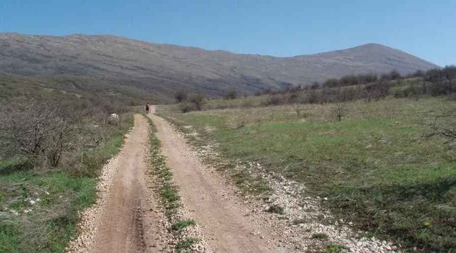
The 9 km dirt track starts from the farming village of Mužinac and climbs 510 vertical meters up the Rtanj slopes. The average gradient is 5.66%, but the actual driving surface is highly irregular. The path consists of a single dirt lane cut by deep water ruts and embedded limestone boulders that strike low underbodies. The final section crosses open meadows near the 1,078-meter mark, where the path narrows down to single tire tracks over a mix of loose shale and soil banks that require a 4x4 low-range vehicle.
What are the driving hazards on the Rtanj mountain track?
The soil and limestone base turns into slick, sticky mud immediately after a heavy rainstorm. The track has no guardrails or concrete barriers on its outer edges, which are constantly eroding into the side ravines. Sudden low cloud banks frequently drop over the Zaječar District peaks, dropping driving visibility down to just a few meters on the unlit mountain face. Sharp limestone fragments stick out from the track surface, presenting a continuous risk of tire sidewall punctures for standard vehicles traveling too fast.
Is the road to Šiljak open year-round?
Heavy mountain snow and ice bury the Rtanj massif from November until late April, making the entire 9 km track completely impassable for wheeled traffic. No snowplow maintenance operates on this route. During the open summer months, heavy downpours frequently wash away sections of the dirt foundation, leaving deep gullies that can high-center a standard car. The route offers zero fuel stations, repair shops, or water supplies beyond the starting point in Mužinac, and the track ends in a tight, dead-end clearing at Dekijeva koliba where maneuvering large vans or trucks is highly restricted.
Pic: http://www.stazeibogaze.info/2009/12/31/rtanj-od-sokobanje-vrh-silak-1561-m/