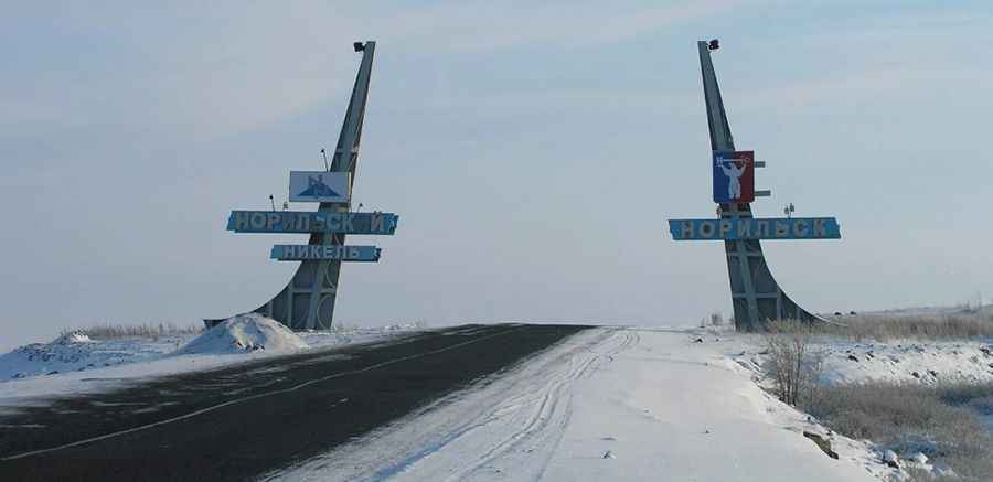
A Perilous Journey: The Frozen Road from Dudinka to Norilsk Above the Arctic Circle
Located above the Arctic Circle, the road from Dudinka to Norilsk, in Russia is a challenging journey through stark tundra.
How long is the road from Dudinka to Norilsk?
The road is 88.3 km (54.86 miles) long, running from Dudinka (the capital of Taimyr on the Yenisei River) to Norilsk, a major mining town notorious for its pollution from metals extraction like palladium, nickel, and copper. It’s the northernmost city globally. Once a slave labor camp, now it’s a center for palladium mining.
Is the road from Dudinka to Norilsk paved?
The road is entirely paved and runs alongside a gas pipeline. Despite being fully paved, the rugged terrain and extreme conditions make it a daunting route. Driving this road is challenging due to the road's uneven surface caused by asphalt laid over permafrost. Norilsk's socio-economic conditions are not easy, with low life expectancies and high cancer rates among residents.
What’s the weather like on the road from Dudinka to Norilsk?
Weather in the region is harsh and unpredictable. Even in summer, temperatures can plummet unexpectedly, creating winter-like conditions. Snow blankets the area for 250–270 days annually, with frequent snowstorms adding to driving challenges. The environment demands careful driving, especially during the three months of continuous darkness when headlights are essential. Winter temperatures often drop below -30 degrees Celsius, contributing to some of the world's poorest air quality.
Is the road to Norilsk open to foreigners?
Access to Norilsk and Dudinka is tightly controlled by the Russian Security Service, requiring foreigners to apply for special permission well in advance. Only around 200 foreigners visit Norilsk annually, as both cities are among the 46 Russian cities designated as 'closed' to outsiders, including both foreigners and Russians.
Pic: Sergey Kashin