How to drive the cross-border transit of Pereval Durbet-Daba?
Pereval Durbet-Daba, also referred to as the Dorbet Pass, is an international high-altitude corridor at an elevation of 2,482m (8,143ft) above sea level. Situated on the border between the Altai Republic of Russia and the Bayan-Ölgii Province of Mongolia, the pass is characterized by a unique 23 km neutral zone between the two customs posts. This sector is a critical logistical link where the high-quality infrastructure of the Chuya Highway meets the rugged, unpaved tracks of western Mongolia.
| Road facts: Pereval Durbet-Daba | |
|---|---|
| Location | Russia (Altai) - Mongolia Border |
| Elevation | 2,482 m (8,143 ft) |
| Road Name | P56 / Chuyskiy Trakt (Russia) |
| Surface | Asphalt (Russia) / Gravel (Mongolia) |
| Neutral Zone | 23 km (14.3 miles) |
What are the surface logistics on the Russian side of Pereval Durbet-Daba?
On the Russian approach to Pereval Durbet-Daba, the road is designated as the P56 (Chuya Highway). Logistically, this is one of the best-maintained high-altitude roads in Asia, featuring wide lanes and high-grade asphalt. The technical design allows for heavy freight transit and high-speed stability. However, as the road approaches the 2,482m summit, drivers must account for rapid weather shifts. Even on perfect asphalt, the friction coefficient can drop instantly during sudden Altai sleet storms. Maintaining standard tire pressures is sufficient for this sector, but mechanical inspections should focus on the braking system before the descent into the neutral zone.
How to manage the 23 km neutral zone at Pereval Durbet-Daba?
The 23 km "No Man's Land" at Pereval Durbet-Daba is a logistical challenge. This unpaved sector between the Russian and Mongolian checkpoints consists of compacted earth and loose gravel. Because it is a neutral zone, regular maintenance is infrequent, often leading to deep ruts and washboard sections. Technically, vehicles must be self-sufficient; a breakdown here involves complex international recovery protocols. It is a mandatory driving protocol to reduce speed to manage the high-vibration environment, protecting the vehicle's suspension and preventing fuel tank punctures from flying stones along the boundary posts.
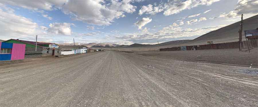
What are the driving requirements for the Mongolian side of Pereval Durbet-Daba?
Upon crossing the Mongolian border at Pereval Durbet-Daba, the road logistics change radically. The asphalt disappears, replaced by a primitive gravel track. This requires a shift in driving technique: engaging 4WD is recommended to maintain directional stability on the loose surface. The gradients on the Mongolian side are less engineered than the Chuya Highway, requiring the driver to read the terrain for large rocks or washouts. Logistically, carrying at least one full-size spare tire and extra fuel is vital, as the distance to the nearest mechanical support in Bayan-Ölgii is significant and the terrain increases fuel consumption by 20-30%.
How does winter impact the transit of Pereval Durbet-Daba?
At an altitude of 2,482 meters, the pass is a high-risk zone during the winter months. While the Russian P56 is often kept open by heavy snow-clearing machinery, the Mongolian side and the 23 km neutral zone can become logistically impassable. Sudden blizzards can bury the track under several meters of snow, and the lack of permanent clearing equipment in the neutral zone makes it a technical trap for non-prepared vehicles. Protocols for winter transit include carrying Arctic-grade diesel, thermal blankets, and satellite communication tools, as temperatures at the Dorbet Pass can drop below -40°C, leading to immediate mechanical and logistical failure.
Pic: Роман Шильмейстер