How is the road surface to Ulagansky Pass in Altai?
Ulaganskiy Pereval is a high mountain pass at an elevation of 2,082m (6,830ft) above sea level, located in the Ulagansky District of the Altai Republic, Russia. As one of the highest paved points in the Altai Mountains, it serves as a crucial gateway for those traveling deep into the Siberian wilderness towards the remote Chulyshman Valley.
The drive is famous for its sudden transitions and spectacular alpine scenery. At over 2,000 meters, the pass offers a panoramic view of the snow-capped North Chuya and Kurai ridges. While the route is a lifeline for local communities, for international drivers, it represents a technical challenge where road conditions can shift from modern asphalt to rough Siberian dirt in a matter of meters.
| Road facts: Ulagansky Pass | |
|---|---|
| Elevation | 2,082m (6,830ft) |
| Length | 51.7 km (32.12 miles) |
| Location | Aktash to Ulagan (Altai, Russia) |
| Nearby Landmark | Ozero Kidelyu Lake |
| Surface | Mixed (Asphalt and Dirt) |
How long is the road to Ulagansky Pass?
The pass road spans 51.7 km (32.12 miles), running in a north-south direction. It connects Aktash, located on the main Chuya Highway (R256), with Ulagan, the administrative center of the district. The drive is relatively straight compared to other Altai passes, but it includes several steep sections that require caution, especially when the pavement ends. The 51.7 km stretch is a gradual climb that takes you from the high steppe into a dense taiga forest before reaching the rocky summit.
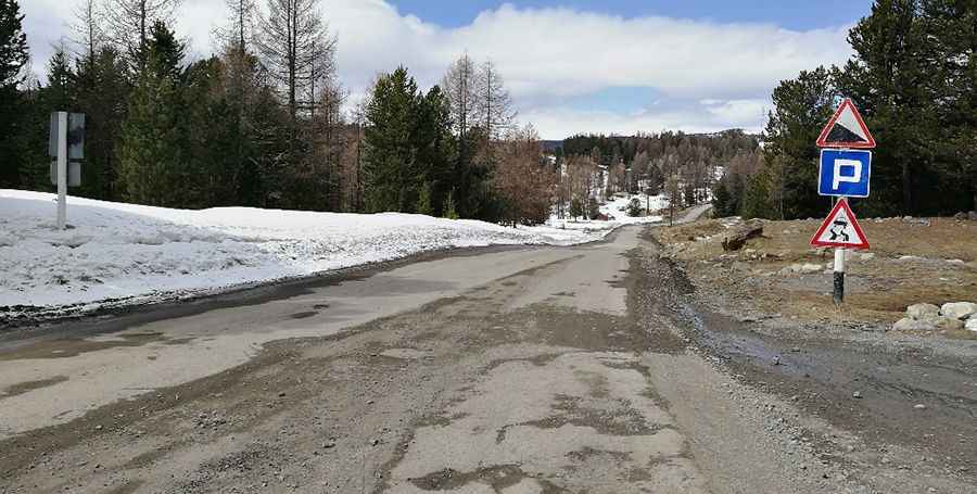
Is the road to Ulagansky Pass paved?
The road surface on Ulagansky Pass is notoriously unpredictable. While sections of the route have been modernized with asphalt, the road remains a work in progress. Drivers should be prepared for the surface to change from smooth asphalt to a defiant dirt and gravel road without warning. During the spring thaw or heavy rains, the unpaved sections can become extremely muddy and slippery, making the 51.7 km drive much more difficult for standard cars. A vehicle with good ground clearance is highly recommended to navigate the potholes and washboard sections common on the northern side of the pass.
What are the main sights along Ulagansky Pass?
Reaching the 2,082m summit is well worth the effort for the views of the North Chuya and Kurai ridges. One of the highlights near the highest point is Ozero Kidelyu, a scenic high-mountain lake that reflects the surrounding larch forests and snow-capped peaks. This area is considered sacred by the local Altai people, and you will often see "kyira" (ritual ribbons) tied to trees at the summit. Beyond the pass, the road continues toward the famous Katu-Yaryk Pass, one of the most dangerous and steep descents in Russia, making Ulagansky Pass an essential first step for any serious Siberian road trip.
Pic: Дарья Баннова