The road to Chike-Taman Pass will take your breath away
Pereval Chike-Taman is a high mountain pass at an elevation of 1,246m (4,087ft) above sea level, located in Ongudaysky District of the Altai Republic, in Russia.
Is Chike-Taman Pass paved?
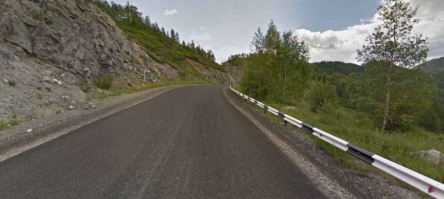
The road to the summit is fully paved. It’s called P256 (also known as Chuiskyi Trakt Road or Chuya Highway), and is the main highway of Altay, joining the main centers of Siberia with distant Mongolia and China.
When was the road through Chike-Taman Pass built?
Today it’s a regular road, but it was a horse path some years ago, extremely dangerous, especially in winter and spring. In 1903, another road was built, and since 1927 it has been possible to drive by car. The road was covered with crushed stone, and only one car could move on it. Drivers often had to give a signal to warn other cars because cars could pass one another only at special pockets. The dual highway was built in 1984. When you drive on the road, parts of the old road are still visible. The new road is carved through granite rocks and forms a serpentine with numerous turns and twists.
How long is the Chike-Taman Pass?
Set high in the Altai Mountains, the pass is 19.7 km (12.24 miles) long, running from Хабаровское се́льское поселе́ние to Kupchegen.
How challenging is the road through Chike-Taman Pass?
The climb is pretty steep, hitting a 13.7% maximum gradient through some of the ramps. Due to its steepness, the pass seems to be much higher. Steep rises, sharp winding roads, abrupt cliffs on the sides, and appearing mountain views will simply take away the breath of all those who pass the pass for the first time, with the marvelous view of the surrounding mountains. Be aware of rockfalls. They often happen after heavy rains or shakes of the earth's crust.