What are the most spectacular roads in Russia?
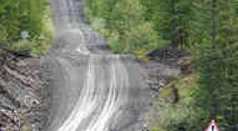
Spread across the vast expanse of Eastern Europe and Northern Asia, Russia is the largest country in the world. With such a large area, the country has 100 roads listed as the most spectacular roads and it is home to extreme driving adventures as well. The treacherous Kolyma Highway is Russia's Road of Bones adventure. It is an exciting trip from Yakutsk to Magadan. It was built by prisoners using hand tools in the 1930s, marking one of the most terrifying chapters in Soviet history. It’s also worth taking the drive through BAM Road, a 4.300 km of off-road route through Siberia. It is one of the toughest adventure roads remaining on this planet. This track runs roughly alongside a railway track in extreme Siberia.
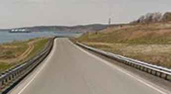
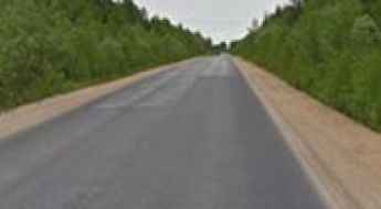
The Trans-Siberian Highway spans 6,800 miles from St. Petersburg to Vladivostok, from the Baltic Sea to the Atlantic Ocean to the Japan Sea to the Pacific Ocean. It’s one of the longest roads in the world. And an epic frozen drive to Anabar is a true Russian adventure leading to Anabar Bay, on the Laptev Sea. It's one of the world's northernmost roads.
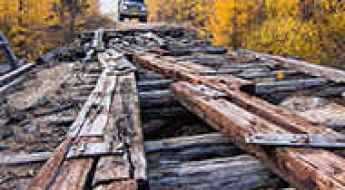
If you prefer spooky drives, don’t forget the terrifying Vitim River Bridge in Siberia. It’s an old train bridge crossing the Vitim River, with its old metal structure covered with rotting wooden planks. It is one of the most spectacular bridges in the world. It’s also worth mentioning the road to Lake Karachay, the most polluted place on Earth. It is considered one of the most polluted bodies of water on Earth, with its waters capable of killing a human within 30 minutes.
For high mountain road lovers, Gara-Bashi station (Mount Elbrus) is a ski lift at 3.883m (12,739ft) above sea level. It's one of the highest roads in Europe.
Driving the Treacherous Kolyma Highway: Russia's Road of Bones Adventure
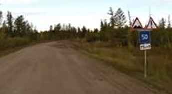
Kolyma Highway is an exciting adventure running from Yakutsk (where the coldest temperature ever recorded outside Antarctica was documented) to Magadan, Russia. It was built by prisoners using hand tools in the 1930s, marking one of the most terrifying chapters in Soviet history.
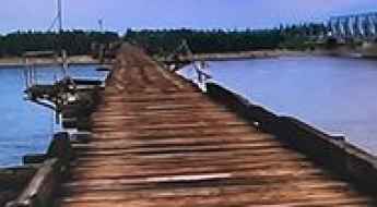
Fear and adrenaline: Traversing the terrifying Vitim River Bridge in Siberia
Tucked away in Siberia, Russia, Vitim River Bridge is one of the most spectacular bridges in the world. It’s an old train bridge crossing the Vitim River, with its old metal structure covered with rotting wooden planks, which can be slippery due to frequent ice in the area.
BAM Road is 4.300 km of off-road through Siberia
BAM Road is one of the toughest adventure roads remaining on this planet, presenting a genuine test of physical and mental endurance. This old railway service track runs roughly alongside a railway track in extreme Siberia, Russia, featuring everything from rickety old bridges to waist-high water crossings and, at points, being miles from civilization.
Trans-Siberian Highway spans 6,800 miles from St. Petersburg to Vladivostok
Stretching almost 7,000 miles from St. Petersburg to Vladivostok, the Trans-Siberian Highway is a network of federal highways that spans the width of Russia from the Baltic Sea of the Atlantic Ocean to the Japan Sea of the Pacific Ocean. Running across some of the toughest environments and terrain around, it’s one of the longest roads in the world.
The road to Lake Karachay, the most polluted place on Earth
Located in Russia, Lake Karachay is considered one of the most polluted bodies of water on Earth, with its waters capable of killing a human within 30 minutes. It has served as a dumping ground for radioactive waste and other hazardous materials from nearby nuclear facilities since the mid-20th century.
Travel guide to the top of Gara-Bashi station (Mount Elbrus)
Gara-Bashi station is a ski lift at an elevation of 3.883m (12,739ft) above sea level, located in the highlands of the Kabardino-Balkarian Republic of Russia. It's one of the highest roads in Europe.
An epic frozen drive to Anabar
Anabar Road is a true Russian adventure leading to Anabar Bay, on the Laptev Sea. At 72°49' North - higher north than the Nordkapp, Prudhoe Bay, or Tuktoyatuk - it's one of the world's northernmost roads.
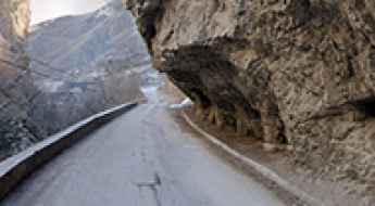
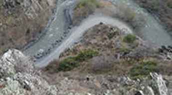
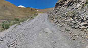
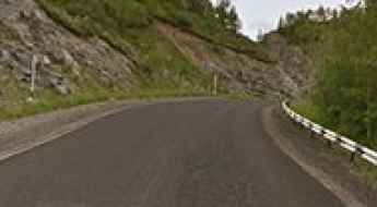
Katu-Yaryk Pass is one of the scariest roads in the world
Pereval Katu-Yaryk is a high mountain pass at an elevation of 1.203m (3,946ft) above sea level, located in the Altai Republic of Russia. The road to the summit is extreme. 4x4 vehicles only. With 19% gradient sections, gravel loose and lack of protections, it’s one of the scariest roads in the world.
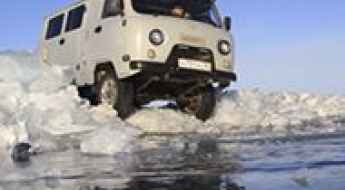
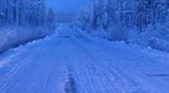
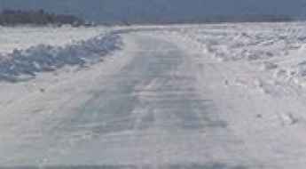
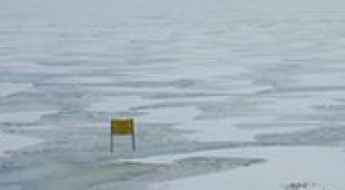
Driving the Ice Road of Lake Baikal in Siberia
Located in the south of the Russian region of Siberia, Lake Baikal is the world’s deepest non-oceanic body of water. When the ice conditions allow it, an ice road is constructed every year.
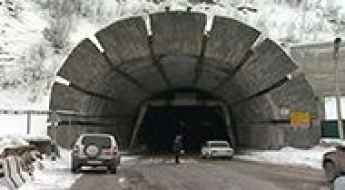
A trip through the challenging Roki Tunnel
Roksky Tunnel is an international high mountain tunnel at an elevation of 2,130m (6,988ft) above sea level, located on the border of North Ossetia–Alania Republic of Russia and Georgia.
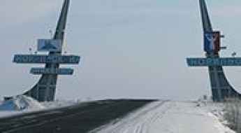
A Perilous Journey: The Frozen Road from Dudinka to Norilsk Above the Arctic Circle
Located above the Arctic Circle, the road from Dudinka to Norilsk, in Russia is a challenging journey through stark tundra.
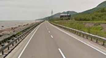
What you need to know about driving the scenic coastal 64H-1 road in Sakhalin
Located on the Sakhalin Island of Russia, the breathtaking yet challenging Road 64H-1 offers stunning coastal views.
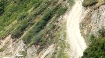
Driving the Challenging Road to Chegem Waterfalls in Kabardino-Balkaria
Chegem Waterfalls, located in the Chegemsky District of the Kabardino-Balkar Republic in Russia, are a notable regional attraction.
Volgograd Bridge is not for the sissies
Volgograd Bridge is 7,1km long. It’s located over the Volga River in the southern Russian city of Volgograd. The bridge is 1.260 meters long and 32 meters wide. Its surface can be seen snaking up and down during high winds. It’s one of the most spectacular bridges in the world.

Driving the slippery Lefortovo Tunnel of Death in Moscow
The Lefortovo Tunnel in Moscow, part of the Third Ring Road, is located in Lefortovo, a suburb of the Russian capital, which is the largest city entirely on the European continent.
Oymyakon Road is the World’s Coldest Winter Adventure Road Trip
Located in the Sakha Republic of Russia, Oymyakon is the coldest village on Earth, with a temperature recorded of -71.2°C. The road to the town, the Oymyakon Road, is said to be the World’s Coldest Winter Adventure Road Trip. During the winter months, travel can be especially challenging due to snow and ice.
The road from Klyuchi to Petropavlovsk is a great adventure
Located in the Far East region of Russia, on the Kamchatka peninsula -Russia's Land of Fire and Ice-, the road from Klyuchi to Petropavlovsk is one of the greatest adventures.
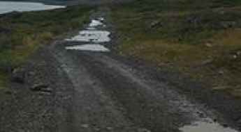
Adventure along the dangerous Lena River Ice Road
Located in the Republic of Sakha in Russia, the Lena River Ice Road connects the port city of Yakutsk on the west side of the river and Nizhny Bestyakh on the east side. It’s said to be one of the most dangerous roads in the country.
How to drive the extreme road to Vayda-Guba?
Vayda-Guba is a small town located in Pechengsky District, in the northwest of Murmansk Oblast in Russia. It’s one of the northernmost points of Europe.
A remote road to Pereval Nevelskiy in the Sakhalin Oblast
Pereval Nevel’skiy is a mountain pass at an elevation of 437m (1,551ft) above sea level, located in the Sakhalin Oblast of Russia. It serves as a vital link across the southern mountain ridges of the island.
The dark legend of Dyatlov Pass: Russia's biggest unsolved mystery
Pereval Dyatlova is a mountain pass at an elevation of 831m (2,726ft) above sea level, located in Russia. The pass has been shrouded in mystery since 1959, following the strange deaths of nine hikers under unexplained circumstances.
Driving the remote coastal road from Korsakov to Novikovo
Located in the Sakhalin Oblast of Russia, the road from Korsakov to Novikovo is a very scenic coastal drive.
R21 Highway is one of the great drives in the world
Located in the western part of Russia, the R21 Highway (Р21 Highway) is considered one of the great drives in the world, running from the Baltic Sea to the Barents Sea.
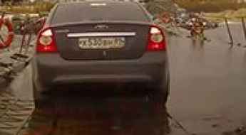
Crossing the hair-raising Nadym River Bridge in Siberia
Located right at the Arctic Circle in central Siberia, Russia, crossing the bridge over the Nadym River (which is frozen for six months of the year) is a hair-raising drive across a waterlogged very rickety pontoon bridge for summer use only. It’s one of the most spectacular bridges in the world.
Driving the international Heihe-Blagoveshchensk Ice Road
The Heihe-Blagoveshchensk ice road is a seasonal route that links Heihe, a city in China, with Blagoveshchensk, a city in Russia.
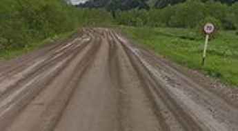
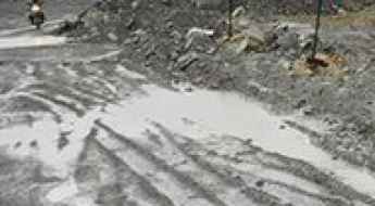
Vilyui Highway is a muddy nightmare in the Sakha Republic
Located in the heart of the Sakha Republic, driving the Vilyui Highway is a true adventure in the Russian Far East, along the Arctic Ocean.
A journey on the legendary Lena Highway
A360 Lena Highway is an unforgettable journey in the heart of the Sakha Republic (Yakutia) in Russia. Known for its remoteness and extreme conditions, it's one of the most challenging and isolated roads in the country.
How to Get to Tsoy-Pede in Chechnya by Car?
Tsoy-Pede, also known as Tsoi-Pede, is a medieval necropolis in the Chechen Republic of Russia. Situated in the Itum-Kale District, near the Argun River, Tsoy-Pede is often called the "City of the Dead" due to its medieval burial structures and monuments. It is one of the largest medieval cemeteries in the Caucasus, recognized among the seven most remote Russian attractions.
86K-14 Road is an awe-inspiring route through extremely remote areas in the Republic of Karelia
The 86К-14 Road offers a spectacular and solitary experience in the heart of the Republic of Karelia, located in the northwest of Russia.
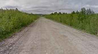
Driving the Wild P25 Highway in Komi Republic
P25 highway is a spectacular and lonely drive in the heart of the Komi Republic, in northwestern Russia.
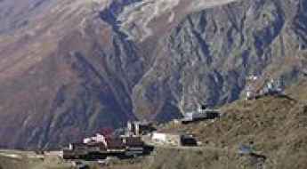
How to Get by Car to the Abandoned Terskol Ice Base?
Terskol Ice Base is an abandoned military complex at an elevation of 3,675m (12,057ft) above sea level, spanning the regions of Kabardino-Balkaria and Karachay–Cherkessia in Russia. It’s one of the highest roads in Europe.
How to get by car to Seminsky Pass in the Altai Republic?
Seminsky Pass is a high mountain pass at an elevation of 1,894m (6,213ft) above sea level, located in the Altai Republic of Russia. Set high in the southwest part of the Seminsky ridge, the pass is also known as Dyal-Menku or Dyal-Menka (“The timeless mountain”) and marks the highest point of the highway.
A chairlift trail to the summit of Mount Mussa-Achitara
Mount Mussa-Achitara is a high mountain peak at an elevation of 3.141m (10,305ft) above sea level, located in the Karachay-Cherkess Republic, in Russia. It's one of the highest roads in Europe.
The road to Chike-Taman Pass will take your breath away
Pereval Chike-Taman is a high mountain pass at an elevation of 1,246m (4,087ft) above sea level, located in Ongudaysky District of the Altai Republic, in Russia.
Pik Terskol: a truly outstanding 4x4 adventure
Pik Terskol is a high mountain peak at an elevation of 3.092m (10,144ft) above the sea level, located in Kabardino-Balkaria and Karachay–Cherkessia of Russia, near the border with Georgia. It’s one of the highest roads of Europe.
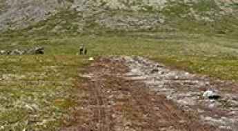
A real adventure on the road from Mirny to Udachny in Siberia
Located just outside the Arctic circle in eastern Siberia, the Mirny-Udachny Road is a real adventure. The drive is strictly off limits to outsiders without a special permit and the authorities regard any foreigners with considerable suspicion.