TransBucegi is one of the most scenic drives in Romania
TransBucegi is one of the most scenic drives in Romania. Along the road, you will feel the need for higher elevation, even fresher air, and sweeping landscapes where you can soak in some of Romania's most breathtaking vistas without even leaving your car. It’s one of the famous high-altitude roads in Romania.
When was the TransBucegi road built?
The construction of the road began in 2010 and was officially inaugurated on August 31, 2013. Situated at the foot of the Laptici Mountains, it’s the third high-altitude road in Romania, after Transfăgărășan and Transalpina.
How long is the TransBucegi road?
Set high in the Bucegi Mountains, within the Bucegi Natural Park, the TransBucegi road, part of the DJ713, is 23.6 km (14.66 miles) long, running from the paved DN71, which connects the resort of Sinaia and Târgoviște, to Costila Peak, at an elevation of 2,485m (8,152ft) above sea level.
How to drive the TransBucegi road?
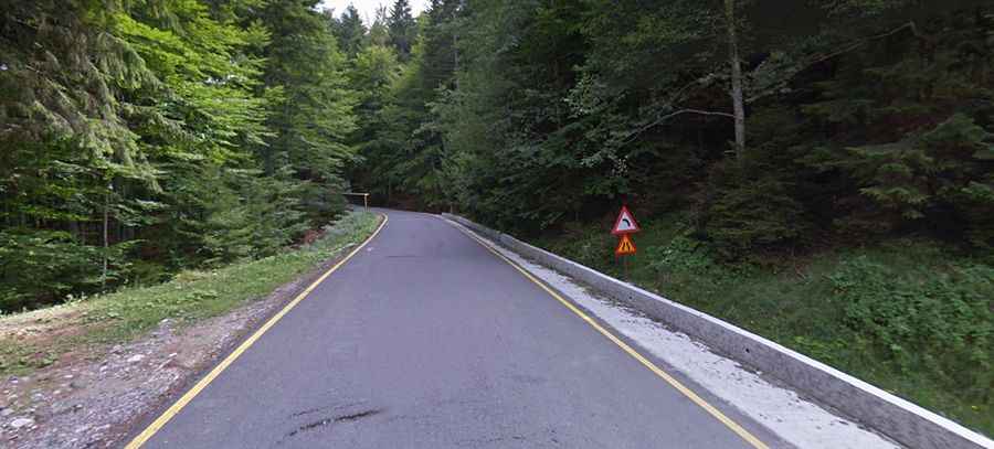
Tucked away in the south-central part of the country, the first 16.4 km (10.19 miles) of the road are totally paved. The TransBucegi road, also called Drumul Babelor, ends at 1,925m (6,315ft) above sea level, in a parking lot. It’s a cul-de-sac road through a land that provides colorful flower and foliage displays as well as numerous hiking trails, leading you straight into the heart of nature. Known as The Old Ladies Road, it is narrow and sinuous, close to The Old Ladies and The Sphinx – famous Romanian rock formations shaped by the wind. The journey is filled with road bends and hairpin curves, unveiling amazing views over the mountains.
The final 7.2km (4.47 miles) are on a brutally steep unpaved road through a protected area and therefore off-limits to riders or drivers. The road is very steep, with a maximum gradient of 10% through some of the ramps. The elevation gain is 545 meters, and the average gradient is 7.56%. The road ends at Costila Peak, a high mountain peak with a radio relay at the summit.