How difficult is the unpaved road to Qafë Vranicë on the Albania-Montenegro border?
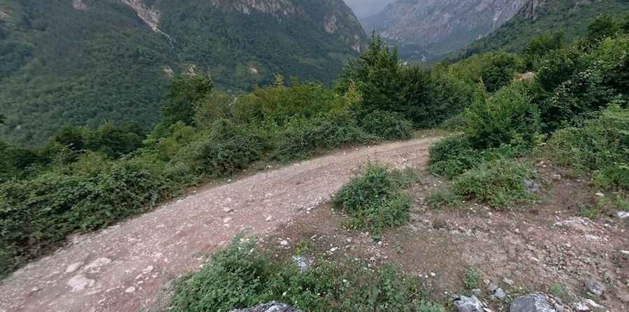
Qafë Vranicë is an international mountain pass at an elevation of 1,630 meters (5,347 ft) above sea level on the border between Albania and Montenegro. Located in the Prokletije range (Accursed Mountains), the unpaved track links Çerem in Kukës County, Albania, with Hoti in Plav Municipality, Montenegro.
| Road facts: Qafë Vranicë | |
|---|---|
| Location | Çerem (Albania) to Hoti (Montenegro) |
| Elevation | 1,630 m (5,347 ft) |
| Length | 12.5 km (7.76 miles) |
| Surface | Unpaved (Dirt ruts, gravel, and mud) |
| Vehicle Required | High-clearance 4x4 mandatory |
Where is Qafë Vranicë located?
The pass is situated on the Albania–Montenegro border in the Prokletije mountains. The 12.5-kilometer dirt route runs north-south, connecting the village of Çerem in northern Albania to Hoti in southwestern Montenegro.
What are the driving conditions over Qafë Vranicë?
The 12.5-kilometer trail is completely unpaved, consisting of deep logging ruts, loose gravel, and sharp limestone rocks. High ground clearance and a low-range 4x4 are required to manage rock steps and prevent tire sidewall damage. The narrow mountain path lacks safety barriers along exposed drops.
What hazards exist on the Qafë Vranicë pass?
Rain quickly turns the dirt track into slick mud, causing traction loss on steep incline ramps. Landslides and rockfalls frequently block sectors of the road. The isolated border crossing has no roadside services, fuel stations, or mobile phone reception.
Is Qafë Vranicë open in winter?
No. Heavy snow buries the 1,630-meter pass from late autumn through early summer, leaving the track completely impassable. Furthermore, border crossing regulations for non-local vehicles must be verified prior to travel, as it is not a fully staffed international border post.
Pic: Dennis Jakupovic