Conquer Stirovnik: A Road to Montenegro's Lovcen Range Summit
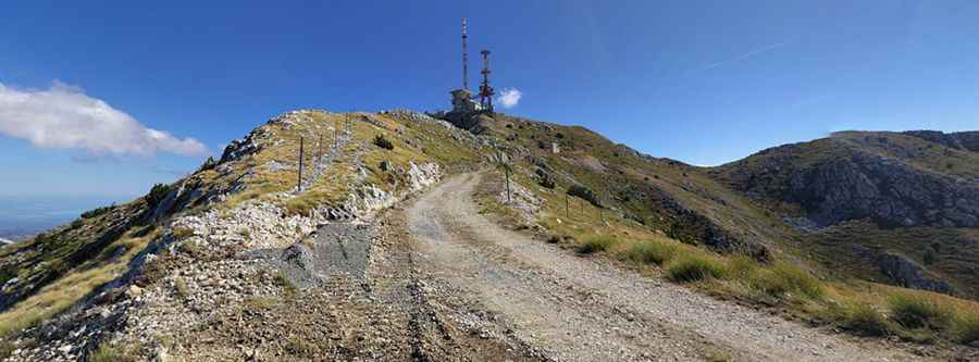
Štirovnik is a high mountain peak at an elevation of 1,675 meters (5,495 feet) above sea level located in the Montenegro's Cetinje Municipality. Set high in the Lovćen range, the road to the summit offers stunning views.
Is the road to Stirovnik paved?
The road to the summit is 10.9km (6.77 miles) long. With 6 kilometers of pavement followed by 4 kilometers of gravel, the road has sharp curves and switchbacks. The drive is pretty demanding, so for less experienced drivers, opting for a taxi might be the right choice.
How steep is the road to Stirovnik?
Starting at the picturesque P1 road, at an elevation of 943 meters above sea level, the road to the summit is 10.9km long. Over this distance, the elevation gain is 732 meters and an average gradient is 6.71%.
Is the road to Stirovnik worth the drive?
Located in Mount Lovćen National Park in the southwestern part of Montenegro, the Štirovnik road is very rewarding, with great views on a funny drive. Located within the Lovćen National Park, the route to Štirovnik is less busy compared to the nearby Jezerski Vrh. The road offers great views of the landscape.
Pic: Daan van Berkel