Courage is required to drive to Sirokar Pass
Širokar Pass is a high mountain pass at an elevation of 1,790 m (5,872 ft) above sea level, located in the Podgorica municipality of Montenegro.
Where is Sirokar Pass?
The pass is situated northeast of Podgorica, in the southern part of the country, just next to the Albanian border.
How long is Sirokar Pass?
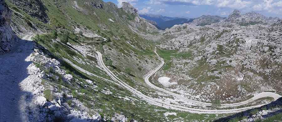
The road to the summit is very challenging. It’s called TT4. It’s 30.9 km (19.20 miles) long, running north-south from Verusa to Korita. The first part of the drive is paved and narrow. But the asphalt road ends at the village of Wet. Beyond this point, the road is very winding and hairpinned, and drivable by 4x4 vehicles with sufficient ground clearance only.
As of 2025, the trail is rougher than it was in 2023 and 2024. There are new washouts, plenty of loose rock, and some narrow sections where you'll need to inch through carefully. The route hasn’t been cleared yet this season (it's usually taken care of by off-roaders or individuals), so expect some light bushwhacking and moments where having a spotter helps. Some parts near Širokar Pass are perched on the edge of sheer drops, and visibility in corners is limited — not a beginner route, but absolutely worth it.
Is Sirokar Pass open?
Set high in the Kuči mountain range, the road is seasonally closed, and impassable in winters.
Where is Rikavacko Jezero lake?
The area is remote, with no mobile signal. Near the summit is Rikavacko Jezero, a high mountain lake located on the border of Montenegro and Albania. It is a glacial lake with a picturesque landscape, surrounded on both sides by mountains on whose slopes are clearly visible traces of glacier run-off, from which water falls and fills the lake. The surface of this lake is 117,755 m², with a maximum depth of 14 meters. Its maximum length is 520 meters and width 325 meters.
The section from Korita to Rikavacko Jezero is in worse condition compared to recent years. It remains quite washed out, and the ruts on the switchbacks are deeper than ever. A vehicle with at least 20 cm of ground clearance is strongly recommended.
Is the road through Sirokar Pass worth the drive?
The drive is very scenic as it provides everything — panoramic ridgelines, deep valleys, heart-racing drop-offs, and wild, untouched alpine terrain. There are still many traditional katuns dotted around the area, and one of the most scenic ones is Katun Ljakovića at the summit of the pass.
Road suggested by: Phil Michalski
Pic: Mirko Baljevic