Peaks of the Balkan Trail — Riding Europe’s Last Remaining Wilderness
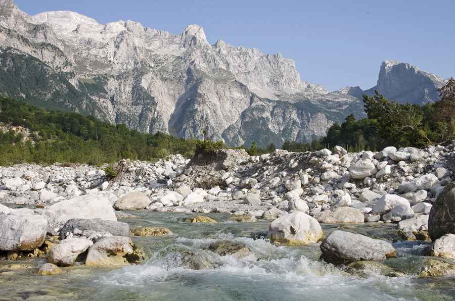
The Peaks of the Balkans trail is a 192-kilometer-long transnational hiking route that passes through Albania, Kosovo, and Montenegro. It traverses the Accursed Mountains (also known as the Prokletije range or Albanian Alps) and is known for its remote landscapes, rugged karst peaks, dense forests, and glacial lakes.
Location and Geography
The trail weaves through the Accursed Mountains, which form a natural border between the three countries. Elevations on the route reach over 2,500 meters, offering expansive views and access to alpine meadows, highland lakes, and traditional villages.
The region includes some of the last stretches of untouched forest in Europe, and Lake Shkoder, the largest lake in the Balkans, lies near the southern access point of the route.
Due to its cross-border nature, permits are required when crossing from one country to another. These can typically be obtained online for Kosovo and Albania, while Montenegro may require a permit issued in person at a local police station.
How to Access the Trail
The trail is most commonly accessed from northern Albania, with common starting points in the villages of Theth and Valbona.
Nearby Towns
- Shkodër: A major city in northern Albania, approximately 70 km south of Theth and Valbona. It serves as a key transit point to the mountains.
- Bajram Curri: A town located closer to Valbona, near the Kosovo border. Also serves as an access point to the trail.
Nearest Airports
- Tirana International Airport (Albania): Roughly 2.5 to 3 hours by road from Shkodër.
- Podgorica Airport (Montenegro): Located near the Albanian border, with road access to Shkodër.
Transportation Options
- Bus: Regular buses connect Tirana with Shkodër and Bajram Curri.
- Car Rental: Renting a car offers flexibility for reaching remote trailheads.
- Shared Taxis and Minibuses: Frequently available from Shkodër to Theth or Valbona during the main hiking season.
The mountainous roads in the region can be winding and slow. Travelers should check road conditions and transportation availability, especially in the offseason.
Accommodation
There are no hotels along the route itself, as the trail passes through remote villages and unmotorable paths. However, local guesthouses are available in Theth, Valbona, and other key locations. These are typically family-run rural homes offering basic amenities and traditional meals.
Accommodation is limited and may fill up during peak months, so making arrangements ahead of time is recommended.
Best Time to Visit
The optimal hiking season runs from June to September. October and early November are still possible for travel, though temperatures drop significantly. Outside of this window, weather conditions are generally unsuitable due to snow or heavy rain.
Similar Remote Trails in Europe
Other parts of Europe with similarly remote and natural terrain include:
- Romania’s Carpathian Mountains: Routes like Viscri to Stejarisu and Sighișoara offer similar wilderness conditions and biodiversity.
- Norway’s fjord region: The road between Nordfjordeid, Geiranger, and Sandane includes fjords, high mountain passes, and gravel sections, resembling the remote feel of the Balkans route.
Summary
The Peaks of the Balkans trail offers an opportunity to explore one of Europe’s most remote mountainous areas, crossing three countries and providing access to diverse landscapes, traditional villages, and dramatic alpine scenery. It is suitable for experienced hikers, cyclists, and pack-animal-supported treks, but requires careful planning due to its remote location and border-crossing requirements.
Image credit: Depositphotos