How to drive the 4x4 road to Ljuboten in the Šar Mountains?
Ljuboten is a high mountain pass at an elevation of 2,112 meters (6,929 ft) above sea level, situated right on the border between Kosovo and the northwestern corner of North Macedonia. It’s one of the highest mountain roads of FYR Macedonia.
| Road facts: Ljuboten | |
|---|---|
| Location | Kosovo - North Macedonia Border (Šar Mountains) |
| Elevation | 2,112 m (6,929 ft) |
| Length | 13.3 km (8.3 miles) from Rogačevo |
| Average Gradient | 9.43% |
| Surface | Totally unpaved / Dirt, ruts, and loose limestone |
Is the road to Ljuboten unpaved?
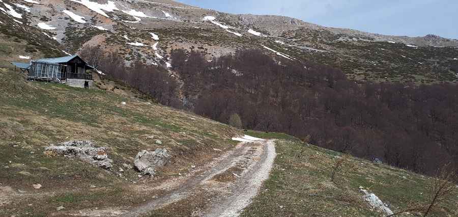
The road to the summit is an unmaintained single-lane dirt track with loose limestone rock shards, deep mud ruts, and steep slopes, with 19 sharp hairpin turns. Near the top sits a historic mountain hut constructed in 1931.
How long is the road to Ljuboten?
Starting from the rural village of Rogačevo, the road to the summit is 13.3 km long. Over this distance, the elevation gain is 1255 m and the average gradient is 9.43%. The hardest sections feature much higher gradients.
How challenging is the road to Ljuboten in winters?
Set high in the rugged Šar Mountains massif, due to its high altitude on the frontier ridge, heavy winter snowfalls bury the entire massif from late October until late May. Regional authorities perform zero snow removal in this border sector, keeping the track completely blocked. Sudden rainstorms quickly turn the dry clay base into a slick mud slurry, while military border patrols frequently check driver identification papers along the narrow track lanes. Sudden storms can drop mountain fog that reduces visibility down to a few meters on a track with no steel guardrails.
Pic: Boban Ilik