How To Have The Ultimate Road Trip To Solunska Glava
Solunska Glava is a high mountain peak at an elevation of 2.526m (8,287ft) above sea level, located in the Republic of North Macedonia. It's one of the highest roads of the country.
Where is Solunska Glava?
The peak is located in the boundary between Čaška and Studeničani municipalities, in the central part of North Macedonia. It’s one of the highest peaks in the country.
How long is the road to Solunska Glava?
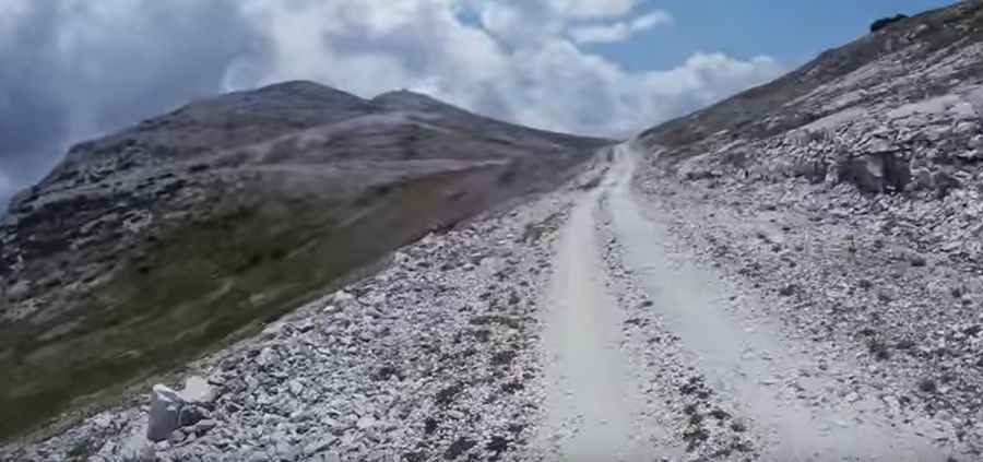
The road to the summit is totally unpaved and suitable for 4x4 vehicles only. If your car is quite low, don't even try. The ascent is 23.2 km (14.41 miles) long starting from Aldinci. Over this distance, the elevation gain is 1,335 m, and the average gradient is 5.75%.
Can I drive to the summit of Solunska Glava?
You can’t drive to the very summit of Solunska Glava. At the summit, there's a military tower (Воена база) with a weather station, and the road is gated at around 2.505m, guarded by armed soldiers.
Is the road to Solunska Glava open in winter?
The road is totally impassable in winters as the region experiences harsh weather with avalanches, heavy snowfall, and landslides, making travel dangerous. The peak is high, with cold, snowy winters and strong winds. Located in the Jakupitsa mountain range, the summit is often cloud-covered due to rising warm air and condensation on the ridge.
Is the road to Solunska Glava worth it?
The drive is definitely worth it. The summit offers wide views covering almost all Macedonian mountains and extending in all directions. The name "Solunska Glava" translates to "Thessaloniki’s head" because, on a clear day, you can see Thessaloniki in Greece. Remember to keep your camera in your backpack near the summit to avoid issues with the military.
Road suggested by: Hugh Wilson
Pic&video: Lupo sto